I was last on Crinkle Crags (my first visit there) this time last year on an evening activation. This time we had a fantastic day to explore the Crags and venture further afield to Bowfell.
Equipment
2m FM QSOs
RIG: Yaesu FT1XD
ANT: Stock whip
PWR: 5w
HF QSOs
RIG: Elecraft KX3
ANT: SOTABeams Quadband Dipole
MAST: SOTABeams compact light-weight 10m mast
PWR: 10w via home-made 3 cell 18650 LiPo battery
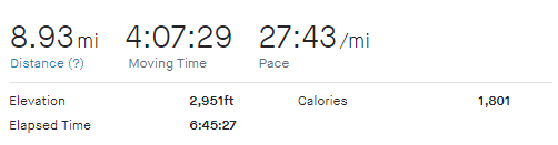
Strava Tracking
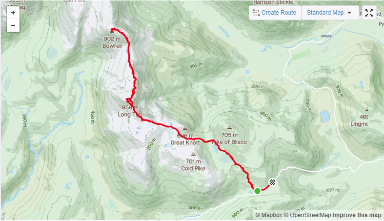
With glorious weather forecast, and thankfully not too hot (especially once a bit of altitude was gained) we set off for a parking spot at the top of Wrynose.
As we avoided the traffic between Windermere and Ambleside once again by taking the scenic route up to Kirkstone Pass and back down the Struggle I thought several times of picking an alternative destination given the tourist situation. In the end it wasn’t too bad on the road up to Wrynose Pass traffic wise.
On the pass itself we struggled to follow a ‘pass noob’ who insisted on ascending in first gear. If it had been wet they would have learnt the hard way why that is a really bad idea!
I was also concerned about lack of parking but the top of Wrynose does have several options. I was fully prepared to park down the pass to secure a place but we managed to tuck on the end of the two spots right next to the three-counties stone.
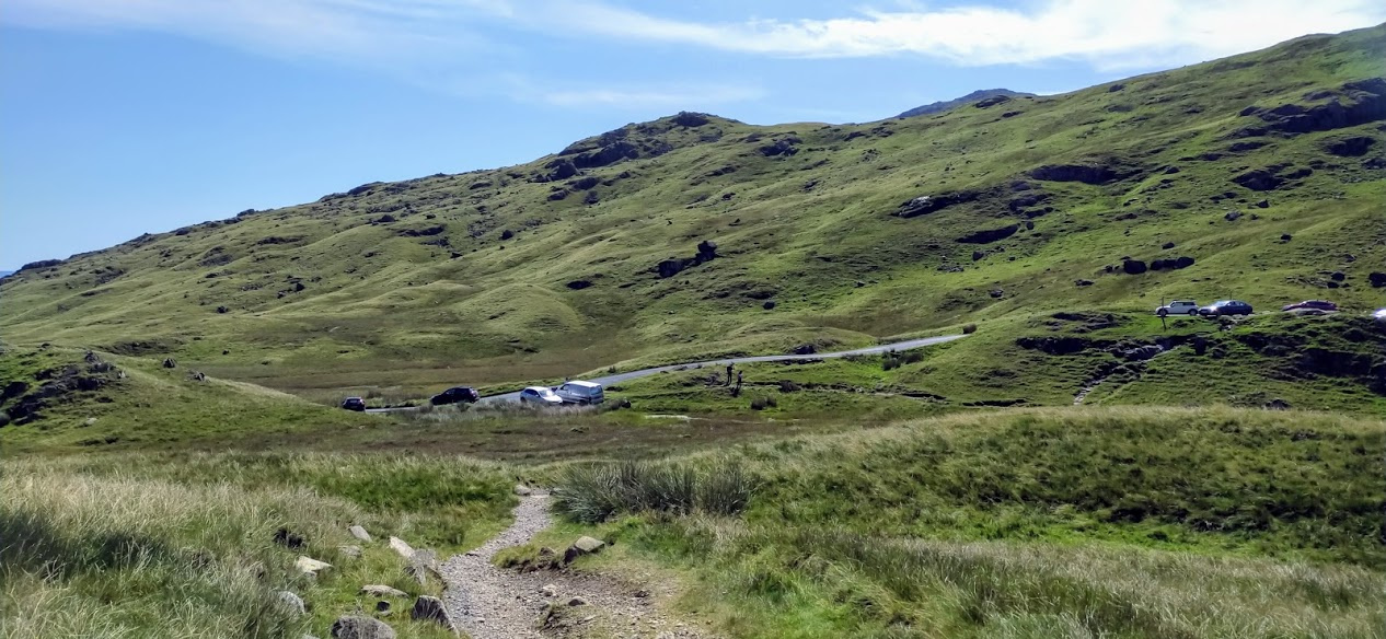
Parking on Wrynose
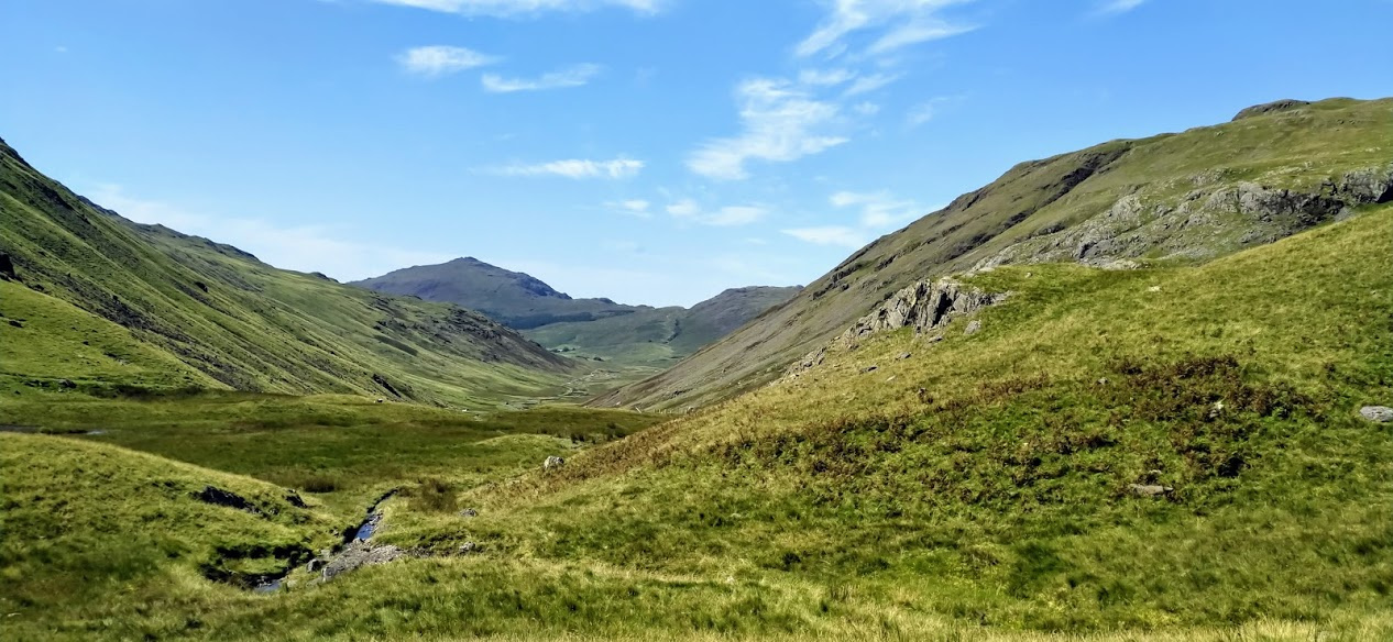
On our last visit here with my wife and eldest daughter we turned right after Red Tarn and went up Pike of Blisco - a summit which affords amazing views for relatively little effort. At the time Crinkle Crags, turning left, would have been a bad idea as we would have run out of daylight. We vowed to return.
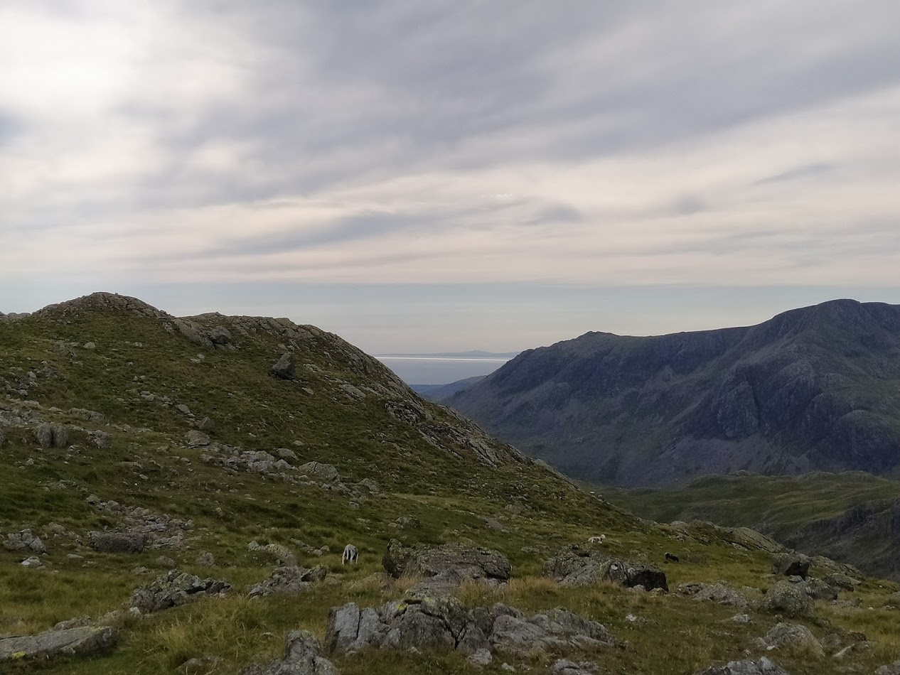
Looking towards Hard Knott pass
Approach from Wrynose Pass via Red Tarn
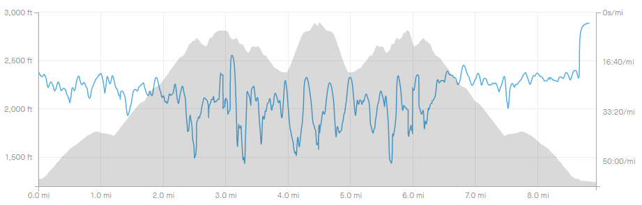
Partly because of the elevated starting position, and partly because of the excellent paths, the rise to the first Crinkle is a very painless and pleasant walk.
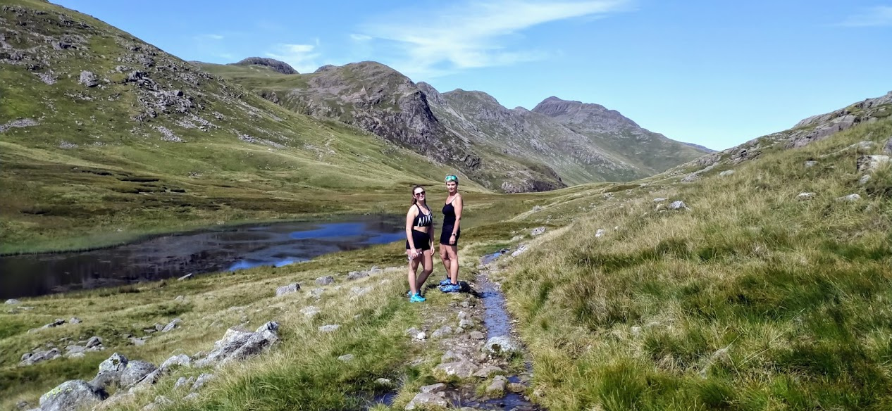
Red Tarn
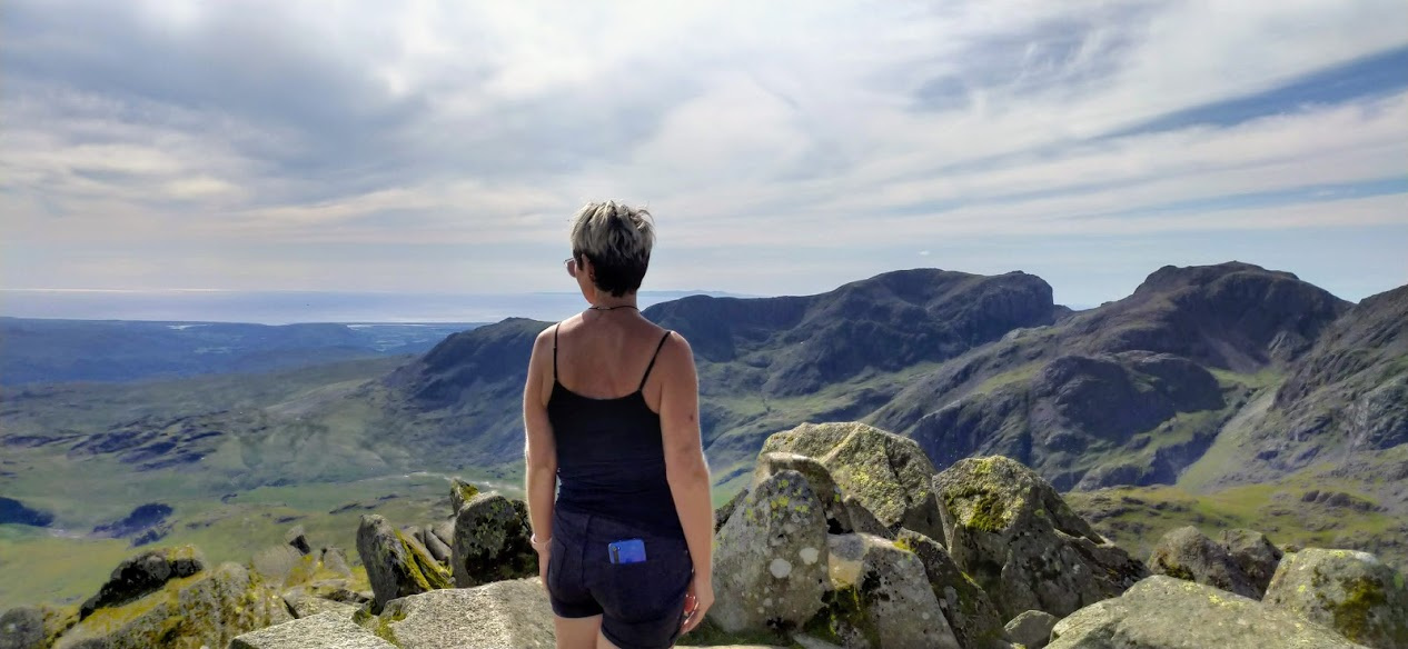
As you crest on to the ridge line the view to the West opens out with excellent views to Scarfell Pike with the Isle of Man beyond.
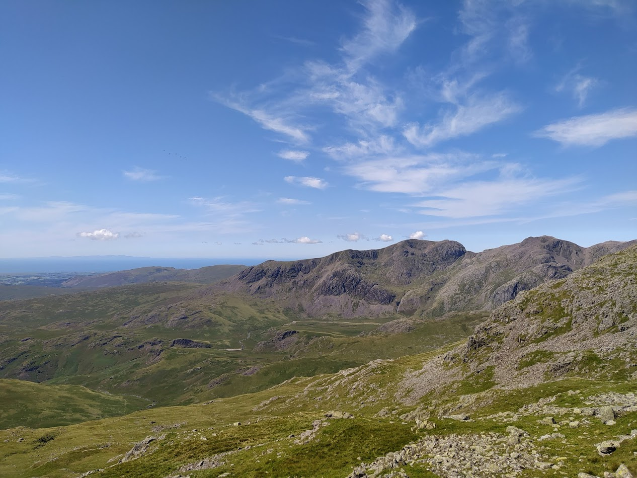
Isle of Man in the distance with Scarfell Pike to the right
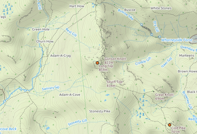
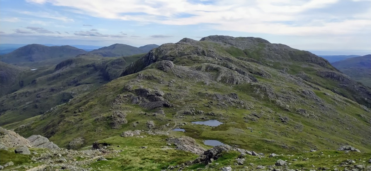
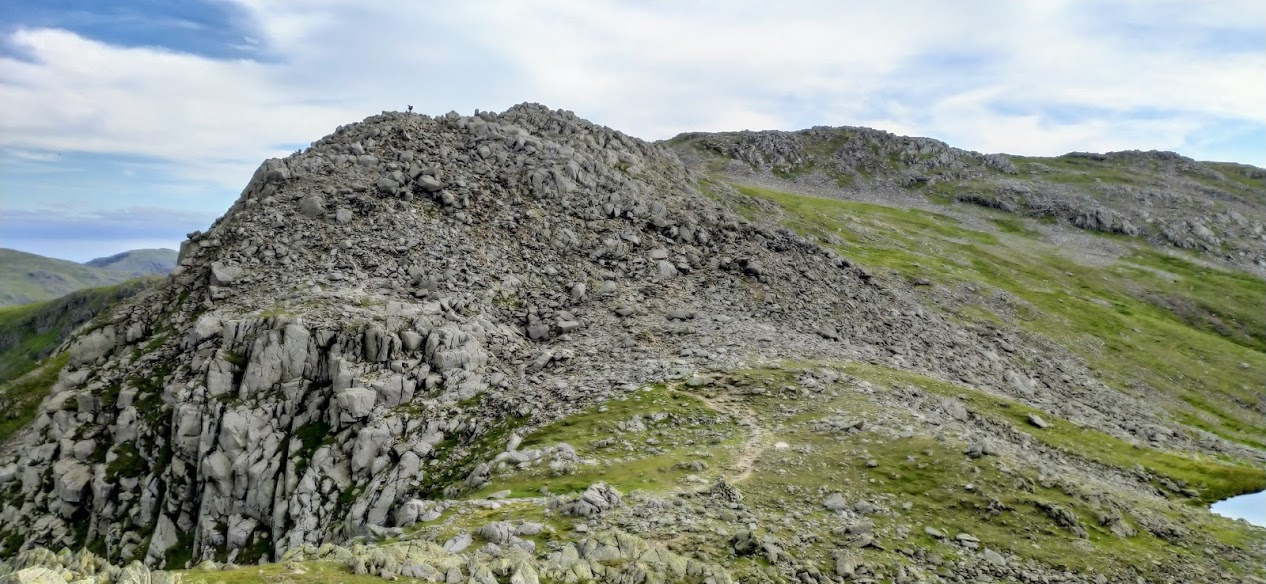
Once over the first Crinkle the second, larger one comes into view. We approached on the Westerly side and I initially did a 2m activation, before moving on to HF. As I had forgotten my BNC to SMA adapter I didn’t have the option of using the Slim-G antenna so it was stock whip on the FT1XD only!
Crinkle Crags aka Long Top
| WOTA ID: LDW-017 | Height: 859 m (2818 ft) |
|---|---|
| SOTA ID: n/a | Grid ref: NY248048 |
| HuMP ID: G/HLD-013 | QTH Locator: IO84KK |
| Book: The Southern Fells | Lat: 54.432911 Long: -3.159423 |
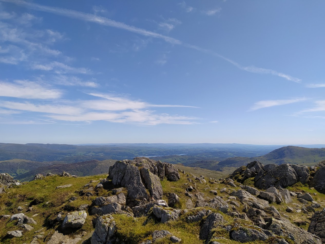
Windermere clearly visible from Long Top

Activating Long Top - Almond powered
| Time | Call | Band | Freq | Mode | Grid | Country | Operator Name |
|---|---|---|---|---|---|---|---|
| 12:31 | G1OHH | 2m | 145.575 | FM | IO84ob | England | Susan Griffin |
| 12:31 | M0XOC/P | 2m | 145.575 | FM | England | OP: Mike, QTH: Morecambe | |
| 12:33 | 2E0XYL | 2m | 145.575 | FM | IO83lg | England | Karen Richardson |
| 12:34 | G8CPZ | 2m | 145.575 | FM | JJ00aa | England | Andy Barth |
| 12:35 | G7CDA | 2m | 145.575 | FM | IO83qt | England | Douggie G7CDA |
| 12:36 | 2E0LBI | 2m | 145.575 | FM | IO84jc | England | Leslie Bell |
| 12:38 | GM4WHA | 2m | 145.575 | FM | JJ00aa | Scotland | GEOFF HARPER |
| 12:38 | G1OAE | 2m | 145.575 | FM | IO84fp | England | TONY STEEL |
| 12:52 | MW0ISC | 80m | 3.755 | SSB | IO83JE | Wales | Steve |
| 12:57 | GI0AZB/P | 60m | 5.385 | SSB | IO64mw | Northern Ireland | Ian Evans |
| 13:04 | M0JOZ/P | 40m | 7.157 | SSB | England | OP: Jo, QTH: Epping Forest | |
| 13:10 | OM0ET | 20m | 14.281 | SSB | KN08UV | Slovak Republic | Paul Timkovic |
| 13:36 | G7KSE/P | 2m | 145.475 | FM | England | WOTA: LDW-122 |
First in the log was Sue followed by Mike who was portable in Morecambe. Then it was great to hear Karen 2E0XYL - apparently back to the radio after a long break. You’ll know Karen because she had her photo on the WOTA front page for a very long time having completed all the Wainwrights.
Once 2m dried up I set the HF equipment up a little away from the summit - basically on the nearest long flat section - the 80m dipole taking up quite a chunk of land! I got an interesting set of contacts, especially nice was to get Ian GI0AZB/P activating a summit in Ireland with his wife Esther GI0AZA/P - she was operating on 40m which unfortunately was too long a skip for a contact.
At the end of HF, once packed up and about to set off, I got G7KSE/P in the log who was on LDW-122 Starling Dodd and travelling along the ridgeline towards Haystacks. It was to be the first of three, someone miraculously timed, WOTA Summit to Summits of the day between us!
Alex and Raine indicated they would be up for extending our original plan to include Bowfell. We had history here - on a week off work with terrible weather last year I decided we’d try for Scafell Pike on the last day. The approach from the Langdale via Mickleden Beck was fantastically over-optimistic. We got as far as Esk Hause - with constant rain - and decided better of carrying on.
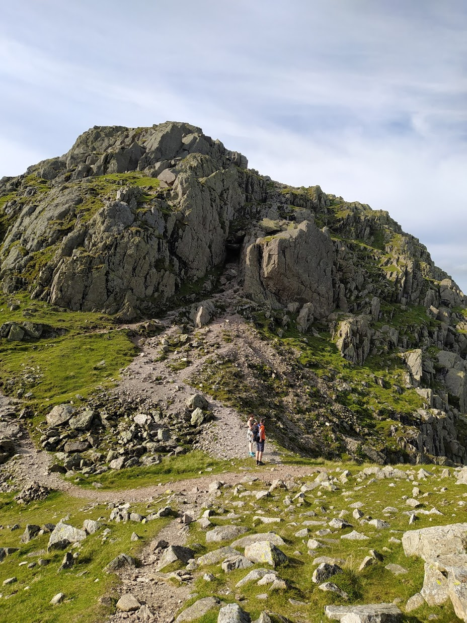
I’d inquired of two walkers approaching the crossroads from Bowfell what it was like, but my spider-senses tingled as we set off in that direction and I decided better of attempting it. Having been there now I know that was 100% the right decision. Bowfell is a very rocky summit and I wouldn’t have fancied that in the cloud and rain.

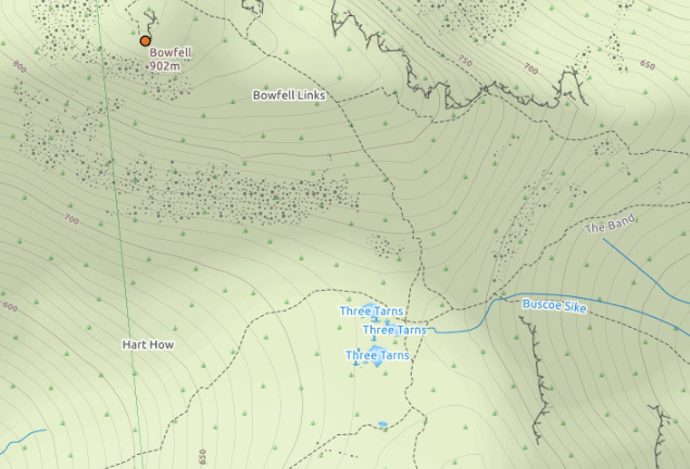
The approach to Bowfell
The walk to Bowfell from Long Top took just shy of an hour. On the bottom of the drop, before the ascent of Bowfell, you come across the magical Three Tarns, one of which is like an infinity pool, a real treat for the eyes.
Three Tarns
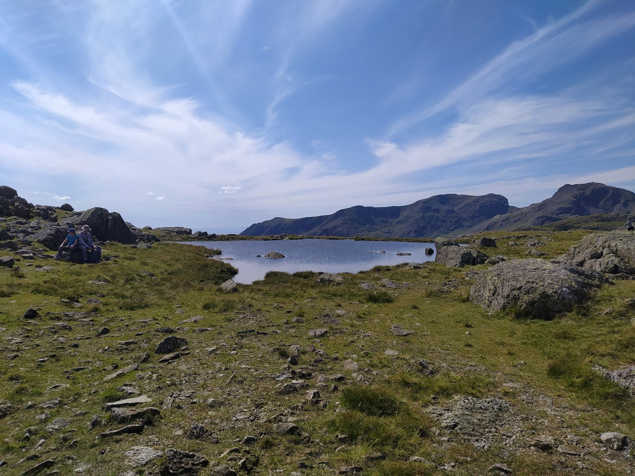
Natural Infinity Pool
On the way to Bowfell we spotted two Paragliders who were clearly having the journey of a lifetime. Paragliders can be spotted regularly in the vicinity of Blencathra as there is a school there, but I have never seen them traversing the summits as they were doing today. Heading South they were last spotted on the way to Wetherlam.

Paragliding in the Lake District
Bowfell
| WOTA ID: LDW-006 | Height: 902 m (2959 ft) |
|---|---|
| SOTA ID: n/a | Grid ref: NY244064 |
| HuMP ID: G/HLD-006 | QTH Locator: IO84KK |
| Book: The Southern Fells | Lat: 54.447229 Long: -3.165997 |
It was clear straight away given the rocky nature of the summit that there was no chance of HF with an 80m dipole. So the activation was via the FT1XD again.
Views towards Scarfell, Scarfell Pike & Great End from Bowfell
| Time | Call | Band | Freq | Mode | Grid | Country | Operator Name |
|---|---|---|---|---|---|---|---|
| 14:39 | GM4WHA | 2m | 145.550 | FM | JJ00aa | Scotland | GEOFF HARPER |
| 14:40 | G7CDA | 2m | 145.550 | FM | IO83qt | England | Douggie G7CDA |
| 14:41 | G0TDM | 2m | 145.550 | FM | IO84oq | England | John Sutton |
| 14:43 | M5GWH/P | 2m | 145.550 | FM | England | QTH: North Staffordshire | |
| 14:45 | G10HH | 2m | 144.613 | C4FM | England | DST: 30.9 miles | |
| 14:48 | G7CDA | 2m | 144.613 | C4FM | IO83qt | England | Douggie G7CDA |
| 14:50 | GM4WHA | 2m | 144.613 | C4FM | JJ00aa | Scotland | GEOFF HARPER |
| 15:00 | G7KSE/P | 2m | 145.450 | C4FM | England | WOTA: LDW-029 |
This time I remembered to do C4FM, as I had promised on the last summit! The second S2S with G7KSE/P was made as he activated the SOTA/WOTA summit of High Stile
After a quick photo session and a snack (not helped by the swarm of flying ants that was being blown around the summit!) it was back off down the boulders again to reverse our steps.

Descending the boulder field that is Bowfell summit
View back towards Crinkle Crags - with Three Tarns in the foreground
The forever up-and-down as you traverse the Crinkles really hit home on the way back, although there was a point where the Isle of Man really popped out in the distance.
Isle of Man looking remarkably close!

Obligatory Sheep Image
Plenty of boulders to tackle on this route
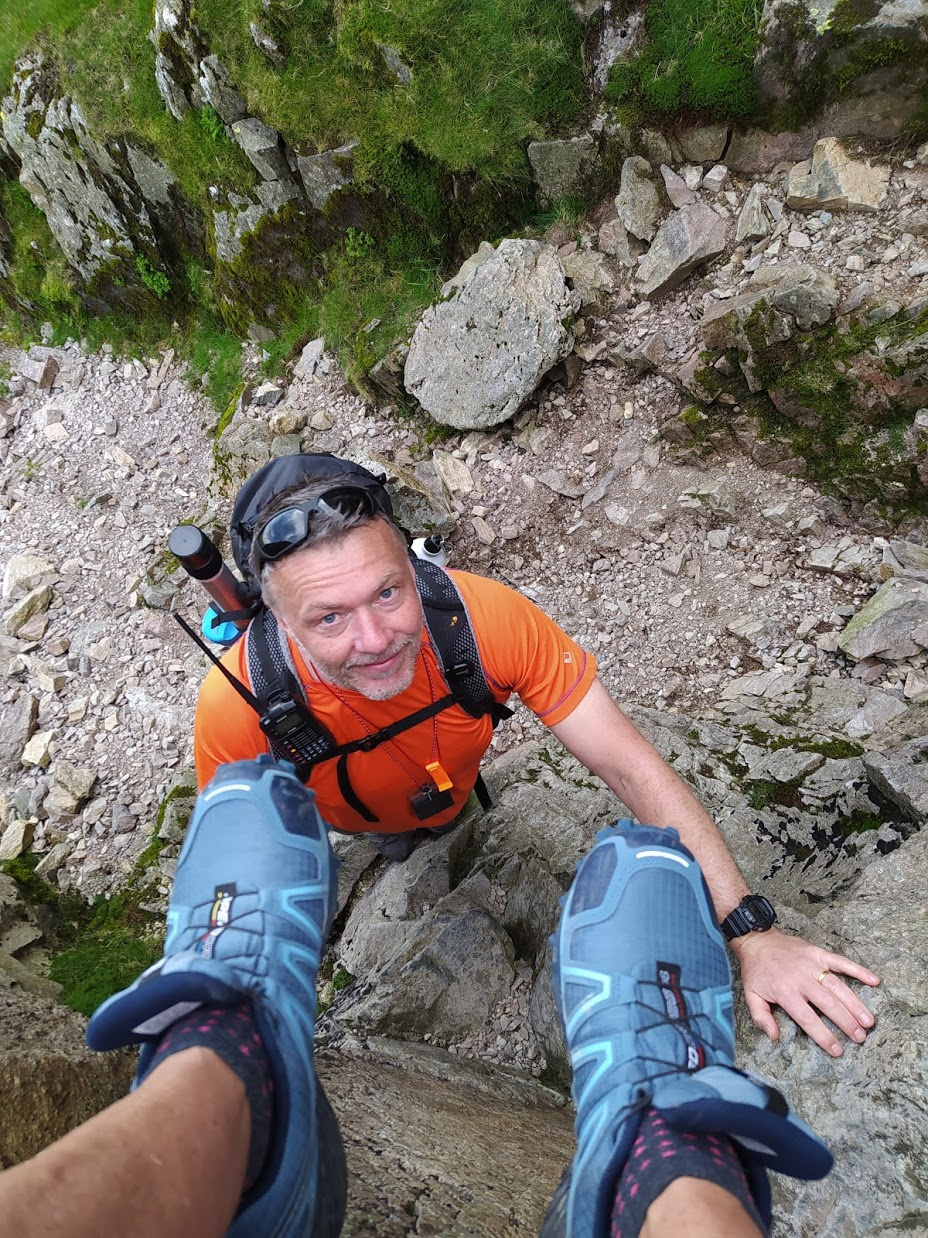
Then, as in my last visit, somehow we managed to pick the Easterly path between the two crags and ended up at Bad Step, once again by pure accident, although I thought Alex and Raine would probably enjoy the challenge. It takes a little bravery, and some careful footing to traverse the rocks down, but you do get an immense sense of accomplishment afterwards - only equalled by relief!
One down, two to go!
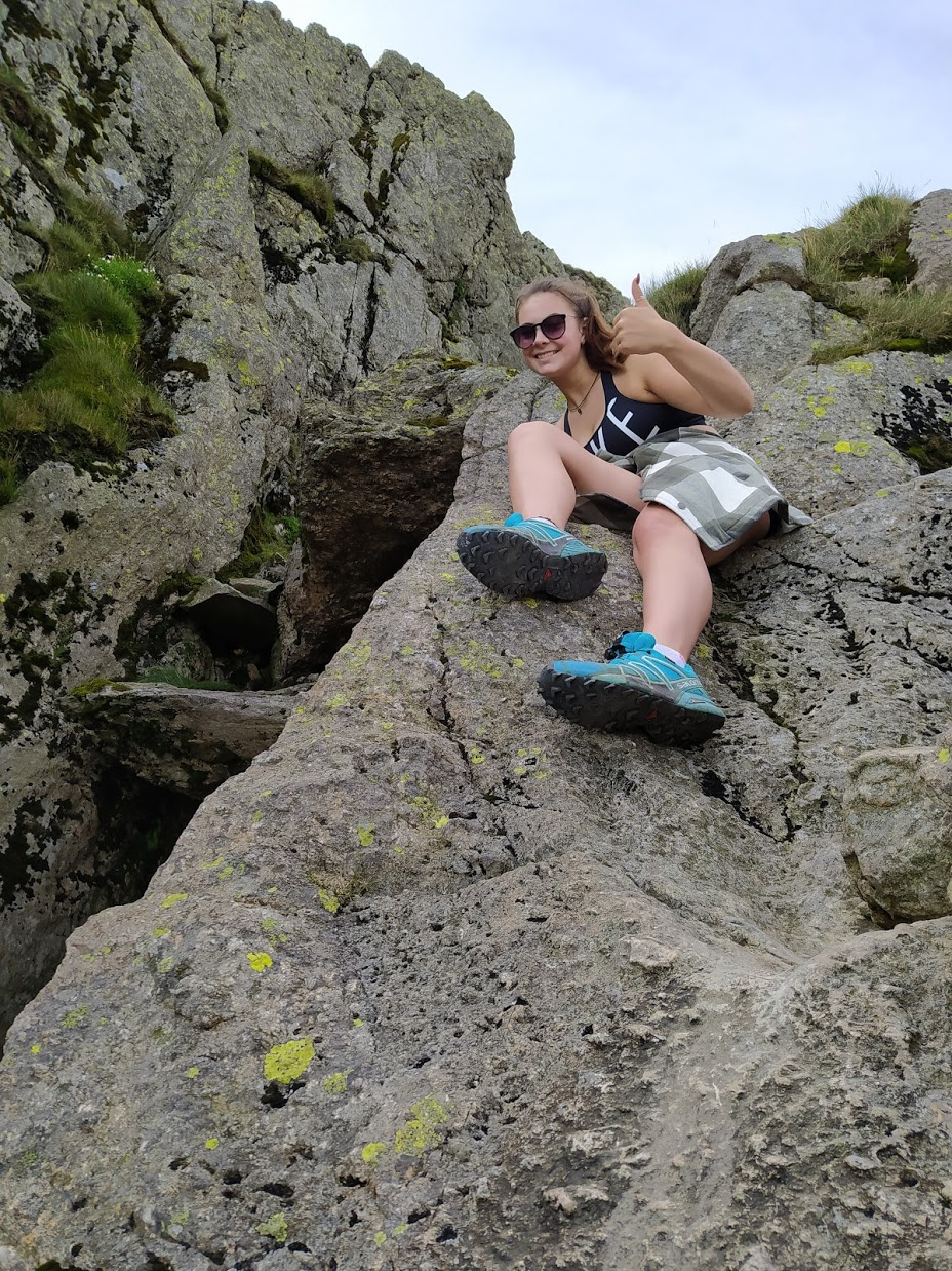
Raine next to Bad Step
Bad Step completed!
Then quite out of the blue I heard G7KSE/P activating High Crag and we were able to complete our set of three WOTA S2S contacts.
Stunning views (not always remembering to stop before looking!) were then soaked up on the long walk back to the car at Wryonse, with the Langdale valley proving once again a great photo opportunity.
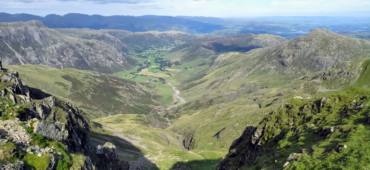
Looking down towards the Langdales
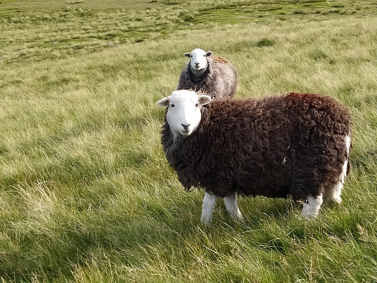
Excessive Sheep Photography!
Given the long day we decided that Cold Pike was too much of a stretch. Our tummies were rumbling and a pub was beckoning.
The nearest on our route home was The Three Shires Inn. We received excellent service and their home-made burgers were a real treat, as was the beer courtesy of my near neighbour Richard who started Bowness Bay Brewing.
Great day walking and radio, a good pint and pub food at the end, doesn’t get any better than this!
Regards, Mark.