Friday Evening, 31-JUL-2020
The WX, family and Gods aligned for a magical weekend walking and playing radio in the Lake District. This is the first of three reports, starting Friday evening after work.
Equipment
2m FM QSOs
RIG: Yaesu FT1XD
ANT: Diamond RH-770
MISC: Diamond SMA to BNC Adapter
PWR: 5w
HF QSOs
RIG: Yaesu FT-817ND
ANT: SOTABeams Quadband Dipole
MAST: Decathlon 6m travel pole
PWR: 5w via internal 1500maH NI-MI battery
All power connections standardized using PowerPole connectors.
Other
Logging: Rite in the Rain 4x6 Notebook and STAEDTLER Noris HB Pencil
Rucksack: Lowe Alpine Airzone Trek 45:55
Phone/Camera: Xiaomi Redmi Note 8T
Water 1 litre (not enough, 1.5 litres would have been ideal)
Snacks: Trek High Protein Flapjack Cocoa Coconut bars x 2
Clothing: Marmot moisture wicking base layer, Regatta waterproof jacket, normal trousers over shorts (mistake not to pack waterproofs), gloves, hat, extra layers.
Footwear: Salomon X Ultra 3 Prime GTX
Safety
- LifeSystems Light and Dry Survival Bivi Bag
- Emergency Plastic Whistle
- Silva Expedition S Compass
- LifePo4 2400mAH battery powers the FT-817 and phone charger
- 12v to USB adapter plus phone charging lead
- Victorinox Swiss Champ Swiss Army Pocket Knife
- Memory Map Android App
- Petzl Aktic headtorch using Panasonic Eneloop Pro AAA batteries with spare set.
- Supertrip Sports Glasses UV400 Protective
- Water purification tablets (only suitable for use on running water)
Preparation
I check the MWIS service and the Lake District Weatherline for accurate weather reports. I keep in regular contact with Alex on Whatsapp at the start of ascents and descents (where possible). Also subscribed to the EmergencySMS service.
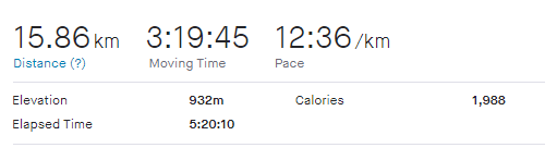
Strava Tracking
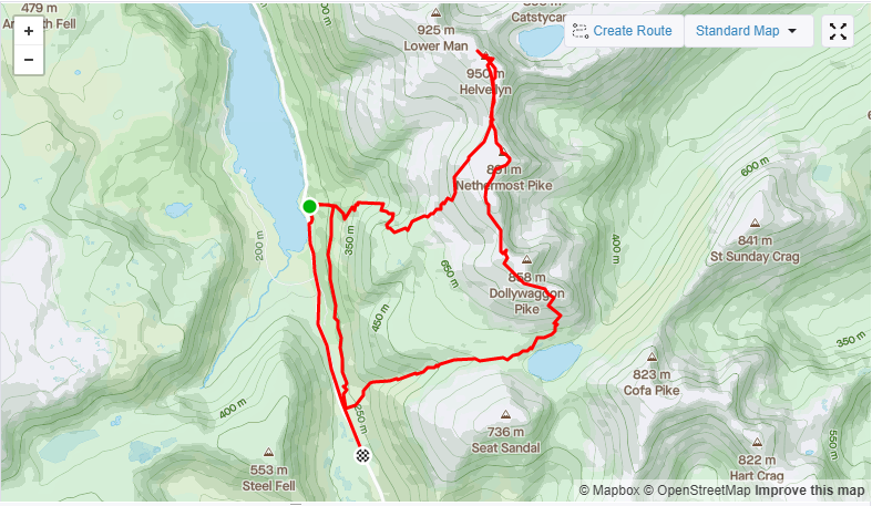
Helvellyn
| WOTA ID: LDW-003 | Height: 950 m (3117 ft) |
|---|---|
| SOTA ID: G/LD-003 | Grid ref: NY341151 |
| HuMP ID: n/a | QTH Locator: IO84LM |
| Book: The Eastern Fells | Lat: 54.526763 Long: -3.018361 |
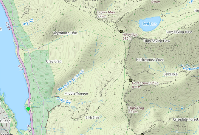
The walk up from Wythburn Church at the South end of Thirlmere reservoir is punishing but with fresh legs and cooling air on what was a scorching Friday I managed to make the summit in just over an hour. If you have the fitness I can’t think of a quicker way to get to a 900m+ summit.
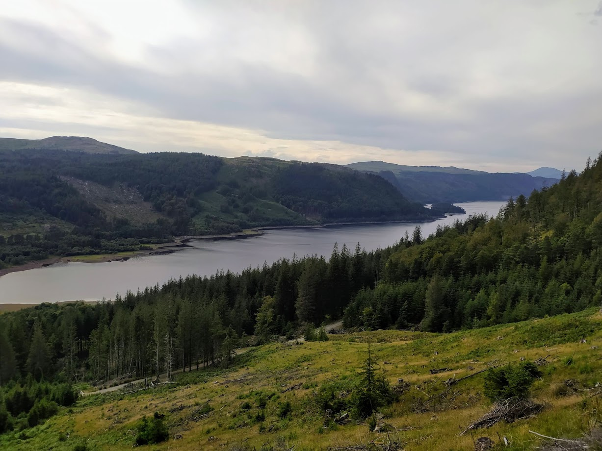
View to the North of Thirlmere
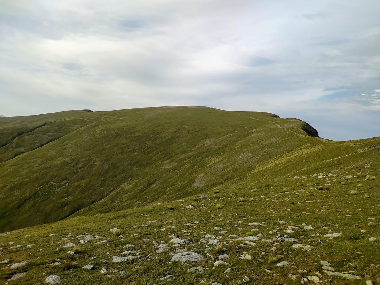
Summit in sight!
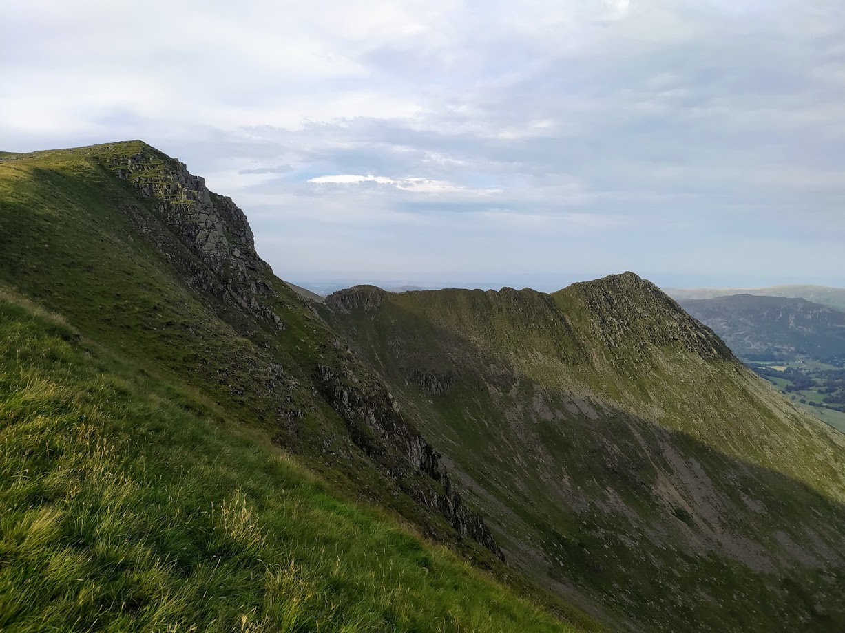
Striding Edge
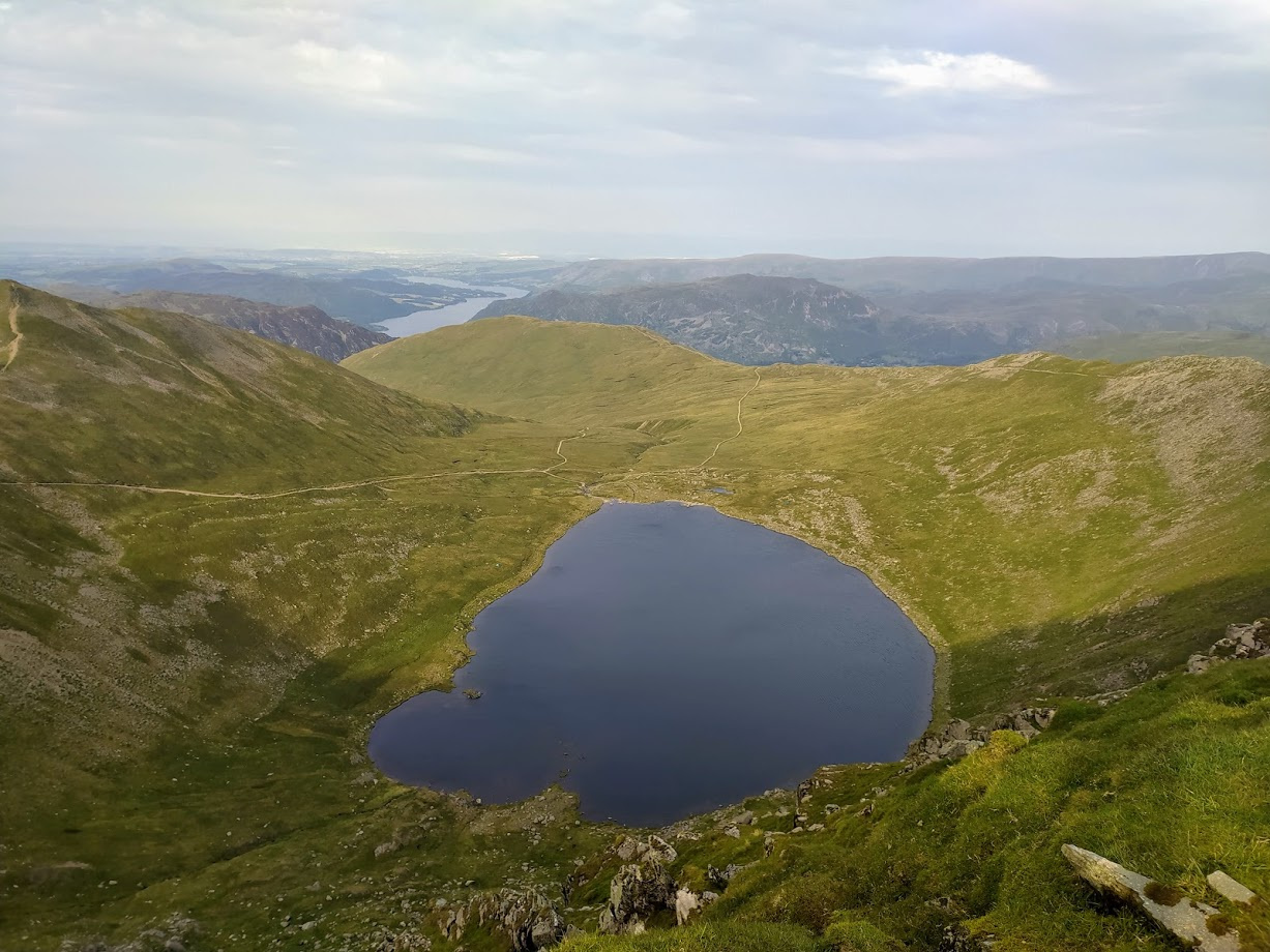
View towards Ullswater past Red Tarn
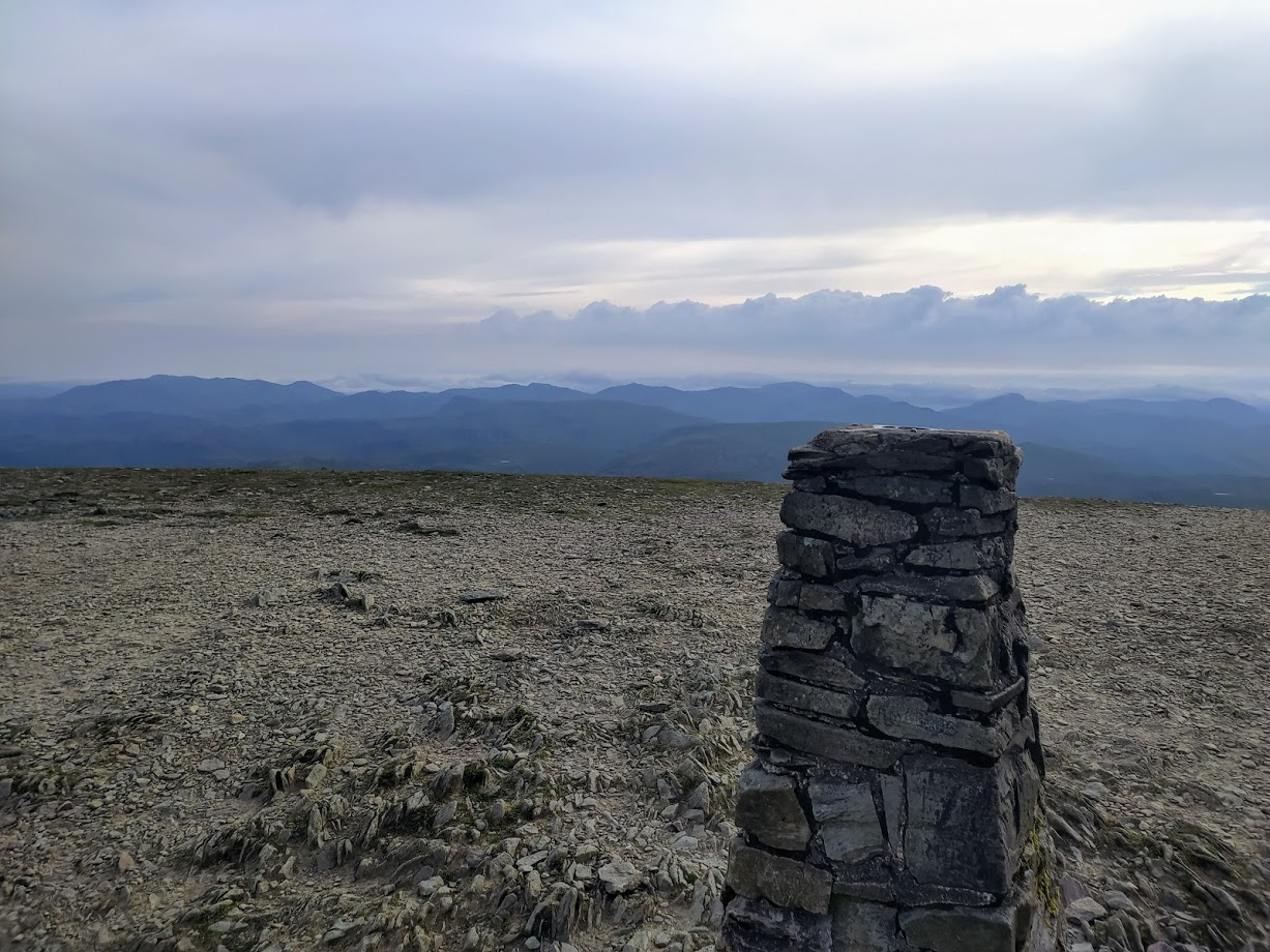
Summit Benchmark, looking West towards the incoming clouds
Even on such a warm day the wind was biting and once again I cursed the weight of clothing on the way up and blessed it on the summit. I hope the two lasses frolicking near the benchmark when I arrived made it down before the weather descended.
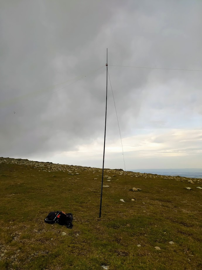
HF setup - note the incoming clouds
I did better on 2m that I have in the past, drawing in both chasers and the curious. @G4OBK was an unexpected surprise at 80+ miles with lots of hills in the way!
I was looking West as I setup HF, and with the clouds rapidly approaching I didn’t hang about. After John in Penrith immediately hit me on 20m straight after 2m I had just one hunt-and-pounce 20m contact after a fruitless CQ session following a self-spot. Evening SOTA isn’t the best for HF contacts. I was glad however that Alex operating as OE60IPA was genuinely pleased to get me in the log. This wasn’t the first (and wouldn’t be the last!) time I questioned hiking with HF equipment!
| Time | Call | Band | Freq | Mode | Grid | Country | Operator Name | Comments |
|---|---|---|---|---|---|---|---|---|
| 17:51 | G7CDA | 2m | 145.400 | FM | IO83qt | England | Douggie G7CDA | |
| 17:55 | G1OHH | 2m | 145.400 | FM | IO84ob | England | Susan Griffin | |
| 17:57 | 2E0MIX | 2m | 145.400 | FM | IO84fn | England | Derek Edge | |
| 18:00 | M7XUP | 2m | 145.400 | FM | IO84gq | England | Stephen Davison | OP: Steve, QTH: Deerham |
| 18:03 | 2E0LKC | 2m | 145.400 | FM | IO83vi | England | peter n cairns | QTH: Heald Green |
| 18:04 | 2E0LMD | 2m | 145.400 | FM | IO83vi | England | anne bate 2EOLMD | |
| 18:07 | G0PJY | 2m | 145.400 | FM | IO83ng | England | P GRAHAM | OP: Peter, QTH: Ellesmere Port |
| 18:11 | G7WAW | 2m | 145.400 | FM | IO83vw | England | David Thompson | OP: David, QTH: Barnoldswick |
| 18:12 | G0UQE | 2m | 145.400 | FM | JJ00aa | England | RJ Weaver | OP: Ron, QTH: Keswick |
| 18:15 | G0MHF | 2m | 145.400 | FM | JJ00aa | England | JOHN L BISSON | OP: John, QTH: Birkenhead, RIG: TR-9000 |
| 18:16 | G4OBK | 2m | 145.400 | FM | IO94of | England | PHIL CATTERALL | |
| 18:28 | G0TDM | 2m | 145.400 | FM | IO84oq | England | John Sutton | |
| 18:29 | G0TDM | 20m | 14.297 | SSB | IO84oq | England | John Sutton | |
| 18:33 | GM4WHA | 2m | 145.400 | FM | JJ00aa | Scotland | GEOFF HARPER | |
| 18:39 | OE60IPA | 20m | 14.167 | SSB | JN78tp | Austria | 60 years I.P.A. in Austria | OP: Alex, QTH: Vienna, SEC: 60YRS Police |
| 18:52 | G8CPZ/P | 2m | 145.425 | FM | England |
The last of the views disappeared rapidly on the way to Nethermost Pike and I wasn’t to have any more views until I descended below the cloudbase on the way down to Grisedale Tarn.
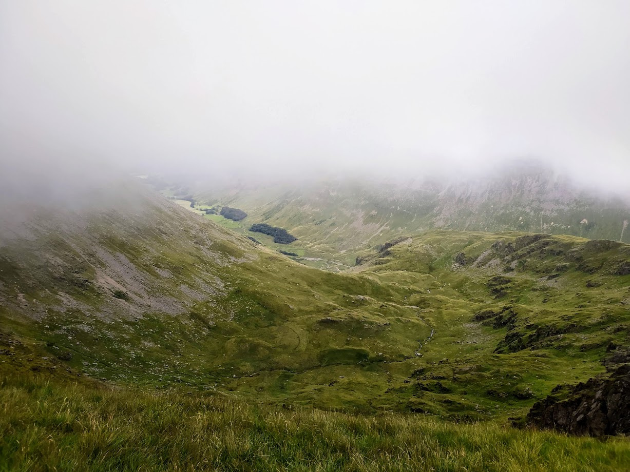
The last of the high views
Nethermost Pike
| WOTA ID: LDW-009 | Height: 891 m (2923 ft) |
|---|---|
| SOTA ID: n/a | Grid ref: NY344141 |
| HuMP ID: n/a | QTH Locator: IO84LM |
| Book: The Eastern Fells | Lat: 54.517816 Long: -3.013503 |
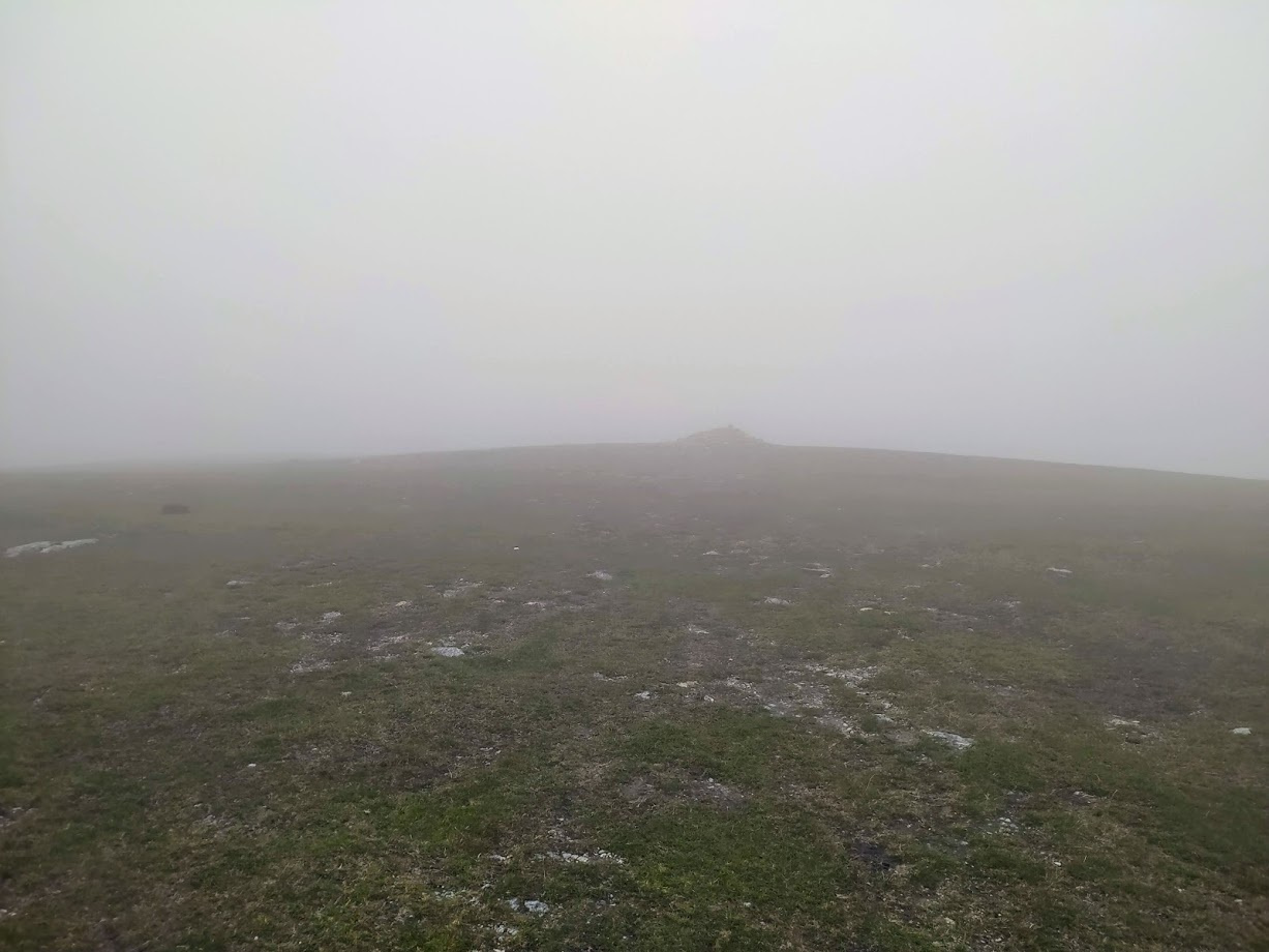
Is this Nevermost Pike? Hard to tell without GPS!
Twenty minutes is all it took to reach the Pike. Last time I passed this summit by when on the SOTA LD weekend, so it was good to get it activating this time.
| Time | Call | Band | Freq | Mode | Grid | Country | Operator Name | Comments |
|---|---|---|---|---|---|---|---|---|
| 19:10 | 2E0MIX | 2m | 145.400 | FM | IO84fn | England | Derek Edge | |
| 19:11 | G7CDA | 2m | 145.400 | FM | IO83qt | England | Douggie G7CDA | |
| 19:11 | M0DXT | 2m | 145.400 | FM | IO84is | England | William Tinnion [BILL] | |
| 19:12 | G1OHH | 2m | 145.400 | FM | IO84ob | England | Susan Griffin | |
| 19:12 | GM6VVG | 2m | 145.400 | FM | IO84cw | Scotland | George Caldwell | |
| 19:13 | 2E0IKM | 2m | 145.400 | FM | IO84fp | England | Mike Moffat | |
| 19:14 | M0MHW | 2m | 145.400 | FM | IO83ro | England | Gary Hardman | |
| 19:14 | M7XUP | 2m | 145.400 | FM | IO84gq | England | Stephen Davison |
Dollywagon Pike
| WOTA ID: LDW-018 | Height: 858 m (2815 ft) |
|---|---|
| SOTA ID: n/a | Grid ref: NY346130 |
| HuMP ID: n/a | QTH Locator: IO84LM |
| Book: The Eastern Fells | Lat: 54.507956 Long: -3.01017 |
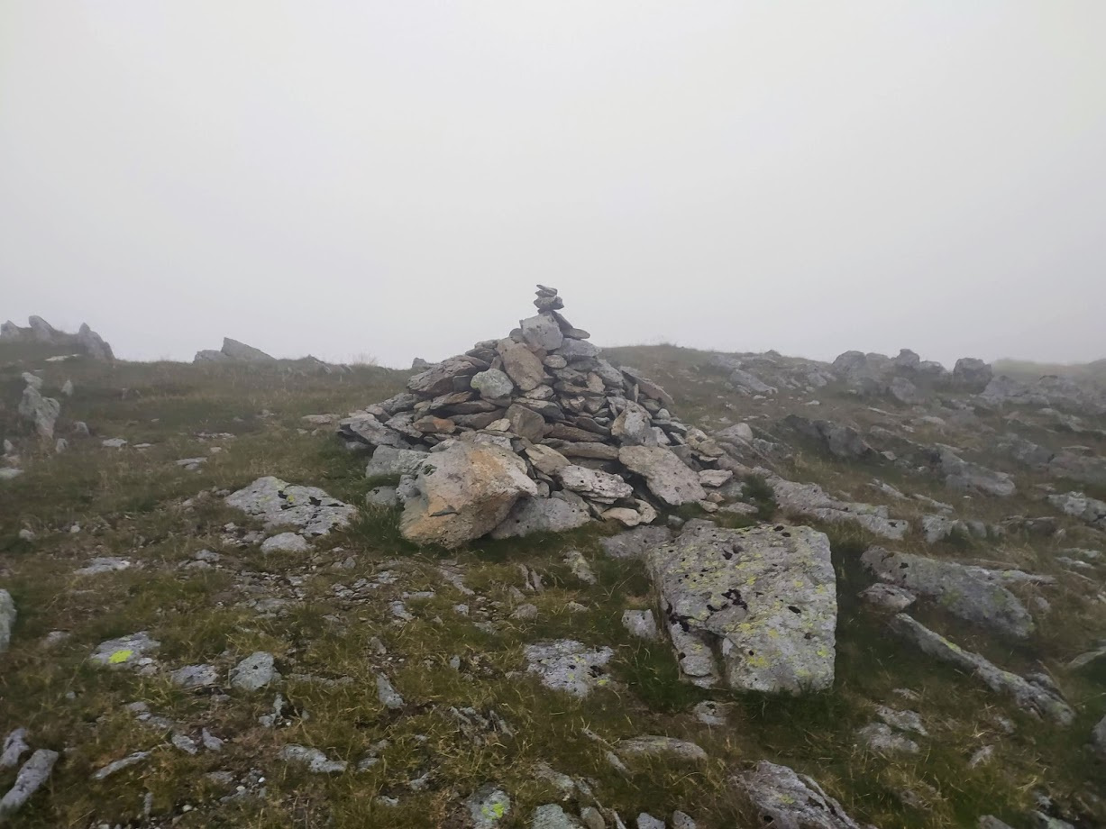
Similar conditions on Dollywagon Pike
Only 20 minutes after Nethermost Pike I hit my final ascent on to Dollywagon Pike. There was a little comical too-and-frowing whilst I determined the summit and after activating I had a couple of doubting moments as to which direction I was descending until the main path came into view.
QSO conditions were strange here - probably due to the moisture having an adverse effect on the poor antenna connection.
| Time | Call | Band | Freq | Mode | Grid | Country | Operator Name | Comments |
|---|---|---|---|---|---|---|---|---|
| 19:34 | M0DXT | 2m | 145.525 | FM | IO84is | England | William Tinnion [BILL] | |
| 19:35 | 2E0MIX | 2m | 145.525 | FM | IO84fn | England | Derek Edge | |
| 19:36 | G0TDM | 2m | 145.525 | FM | IO84oq | England | John Sutton | |
| 19:36 | G6LKB | 2m | 145.525 | FM | IO84ke | England | David WARBURTON | |
| 19:36 | G1OHH | 2m | 145.525 | FM | IO84ob | England | Susan Griffin | |
| 19:37 | G7CDA | 2m | 145.525 | FM | IO83qt | England | Douggie G7CDA | |
| 19:37 | 2E0MOW | 2m | 145.525 | FM | IO83LU | England | Chris R. Naylor | |
| 19:38 | 2E0IRM | 2m | 145.525 | FM | JJ00aa | England | Ian R Martin-Taylor | |
| 19:38 | M0TRI | 2m | 145.525 | FM | IO84PP | England | Andrew J Field | |
| 19:38 | 2E0IKM | 2m | 145.525 | FM | IO84fp | England | Mike Moffat | |
| 19:39 | M7XUP | 2m | 145.525 | FM | IO84gq | England | Stephen Davison | |
| 19:40 | GM4WHA | 2m | 145.525 | FM | JJ00aa | Scotland | GEOFF HARPER | |
| 19:41 | M0MHW | 2m | 145.525 | FM | IO83ro | England | Gary Hardman | |
| 19:42 | M5TUE | 2m | 145.525 | FM | IO84qi | England | Nigel Wadsworth |

Grisedale Tarn
The descent to Grisedale Tarn from Dollywagon Pike was uneventful and it was nice to get out of the cloud. The main path was leading me away from my destination of Dunmail Raise via Raise Beck so I had to deviate and follow a wet and slippy grass path (leading me right past two wild campers, tucked up for the night). This gave me my only ‘moments’ of the journey, fortunately just some wet slipping and hands down activity, mixed in with a healthy amount of cursing.
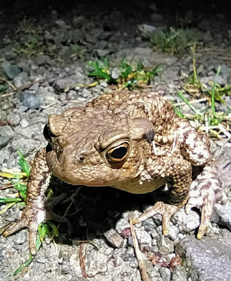
The descent next to Raise Tarn was a thoroughly miserable affair as the predicted rain started and I got a right soaking in the darkness with, by this time, head torch deployed. At Dunmail Raise I followed the path back to Wythburn Church - finally hitting the forestry track which rises somewhat annoyingly at the end of such a long walk. The track was littered with frogs, one posing for the camera, and one unfortunately catching the end of my boot for a tumble, thankfully unharmed!
This is definitely the right way round to do this loop - I wouldn’t have fancied the steep staircase down to Wythburn Church in the wet. I pity the wild campers who thought they were going to have a magical evening!
Happy to have a photo taken!
p.s. I forgot to turn the GPS off so there is a km of motorbike ride at the end added on to the total distance before I remembered back at Dunmail Raise!

