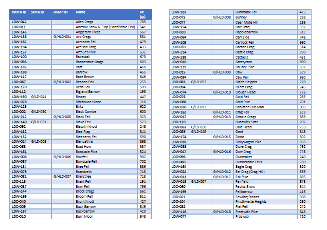
I am often caught short with phone signals and the like, so I’ve created the attached summit reference sheets. I’ve printed them A4 double sided and laminated them, so they have half a chance of surviving outings!
They are a large enough font size too for me to see (albeit at arm’s length!)
With reference to handy lists, just to note that I have previously published a list of exactly which WOTA Outlying Fell is which online at my dormant blog, accessible via the menu on the WOTA website. Some tops are obvious, but identifying a few of the tops can be tricky! Stated altitude in metres can help to tie in with OS maps.