A favourite spot to bag four Wainwrights with a combined SOTA in a couple of hours!
The walk to Top O’Selside was via a permissive vehicle track that ascends from the centre of High Nibthwaite. They are currently renovating a large building just to the North of the track entrance and that has created a row of parking spaces.
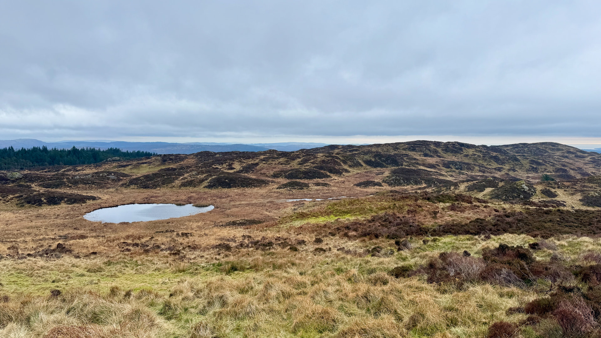
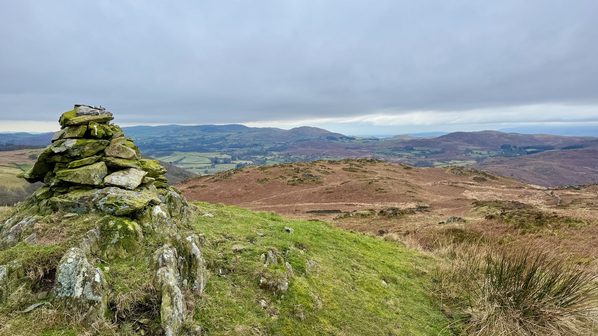
The Northerly walk is very pleasant and consists of varying gradient of ascent, until you turn to the East, parallel with the summit. There is new fencing in this area but with plenty of pedestrian gates.
The weather was light drizzle on and off, clearing later as I proceeded off Top O’Selside South to the other WOTAs.
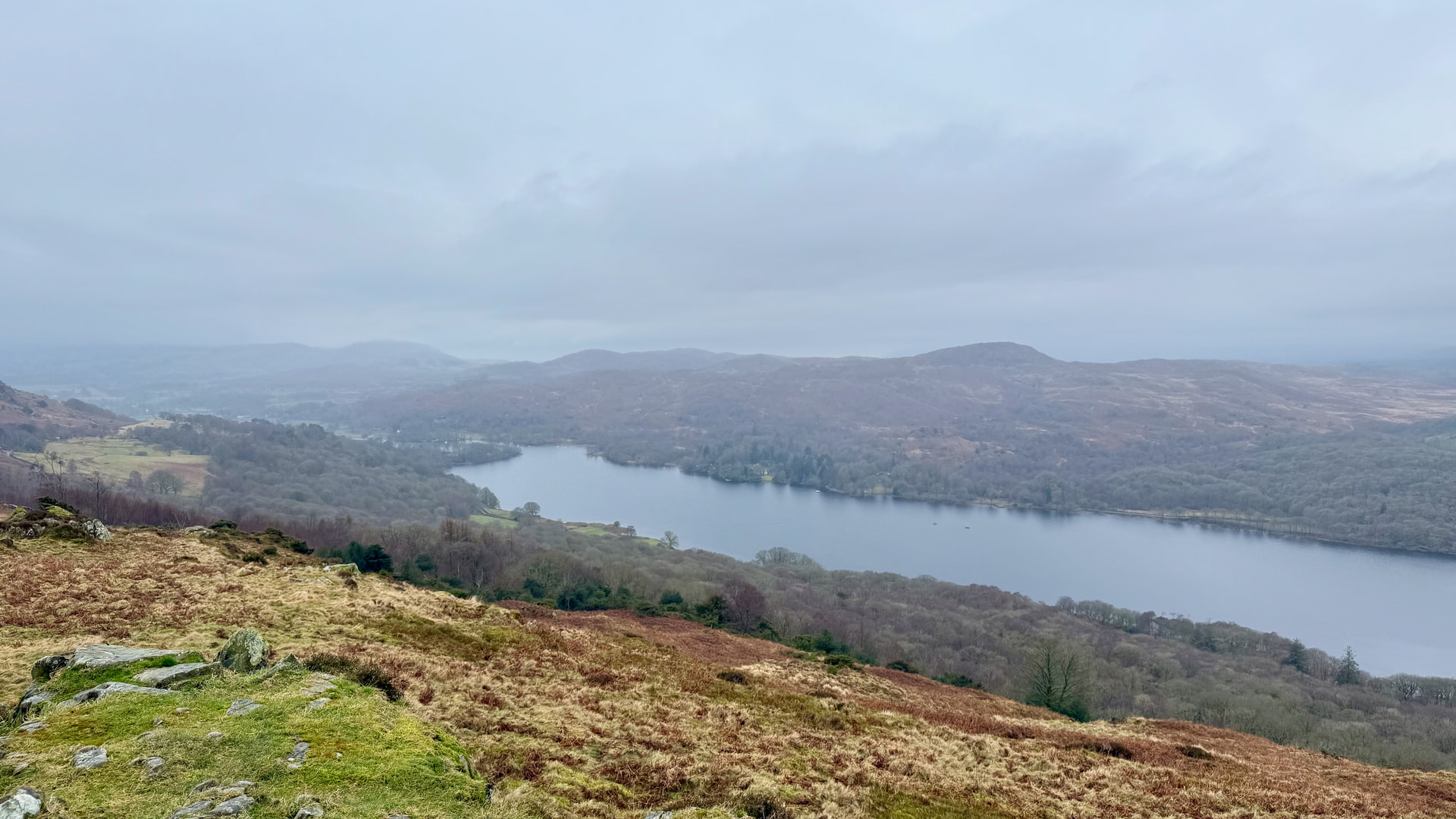
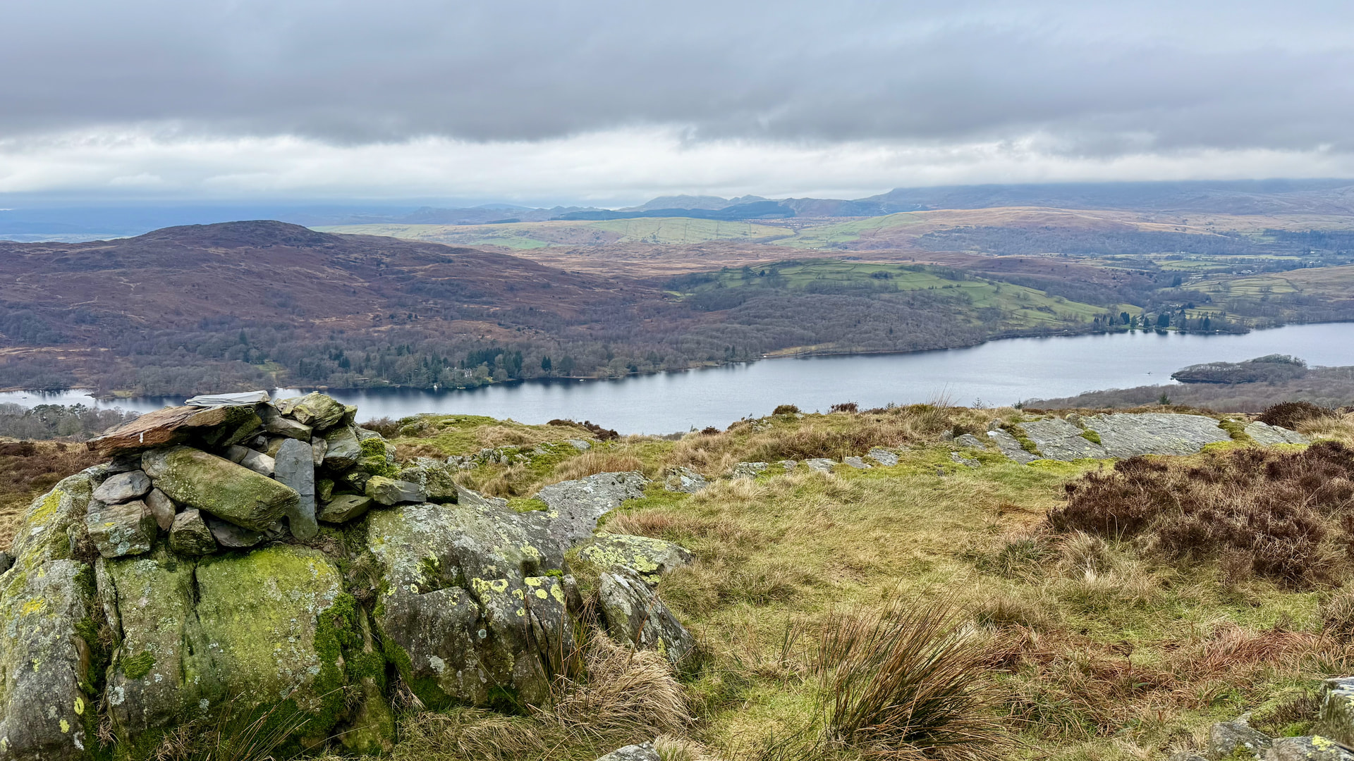
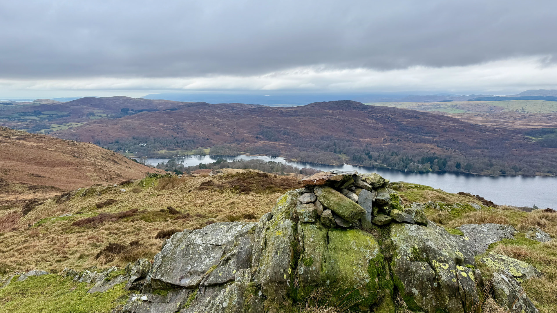
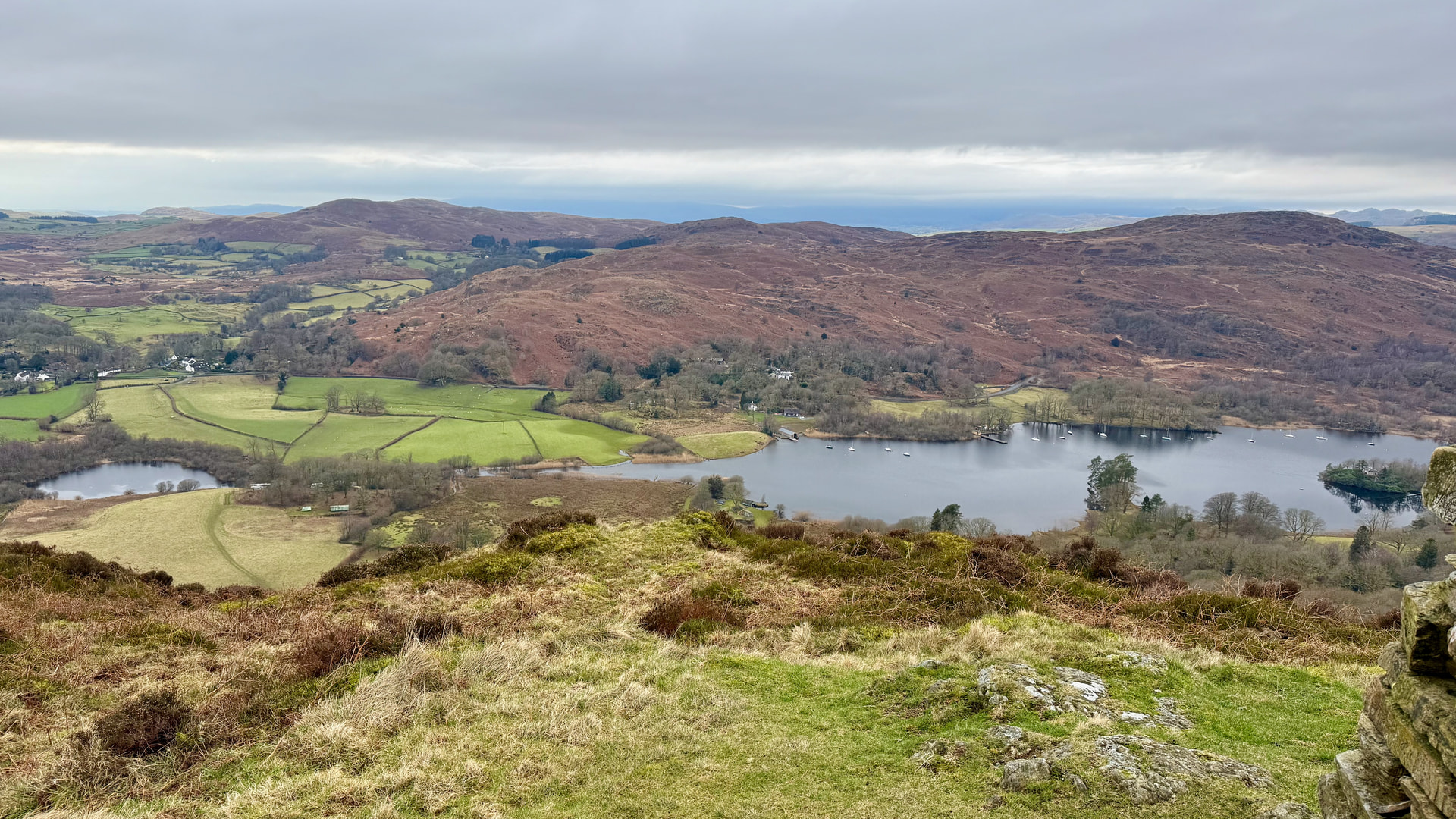
Views to the South of Coniston Water
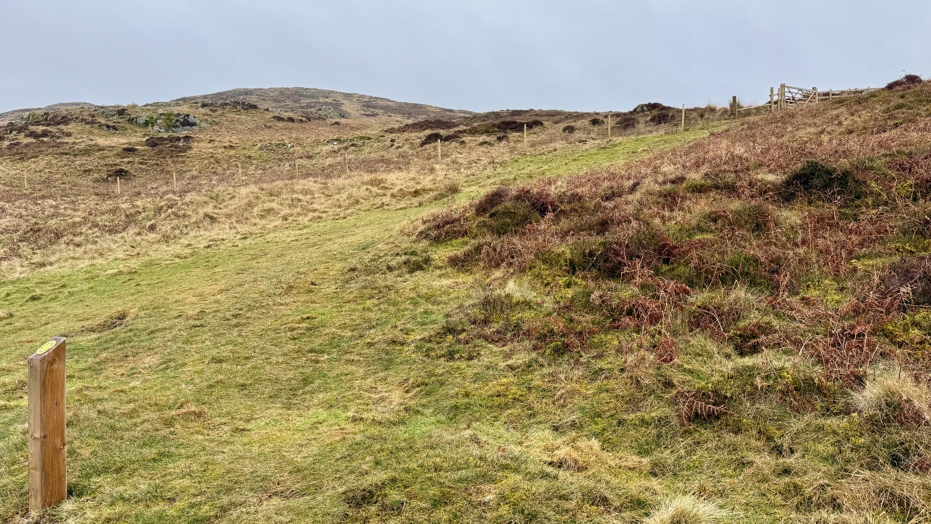
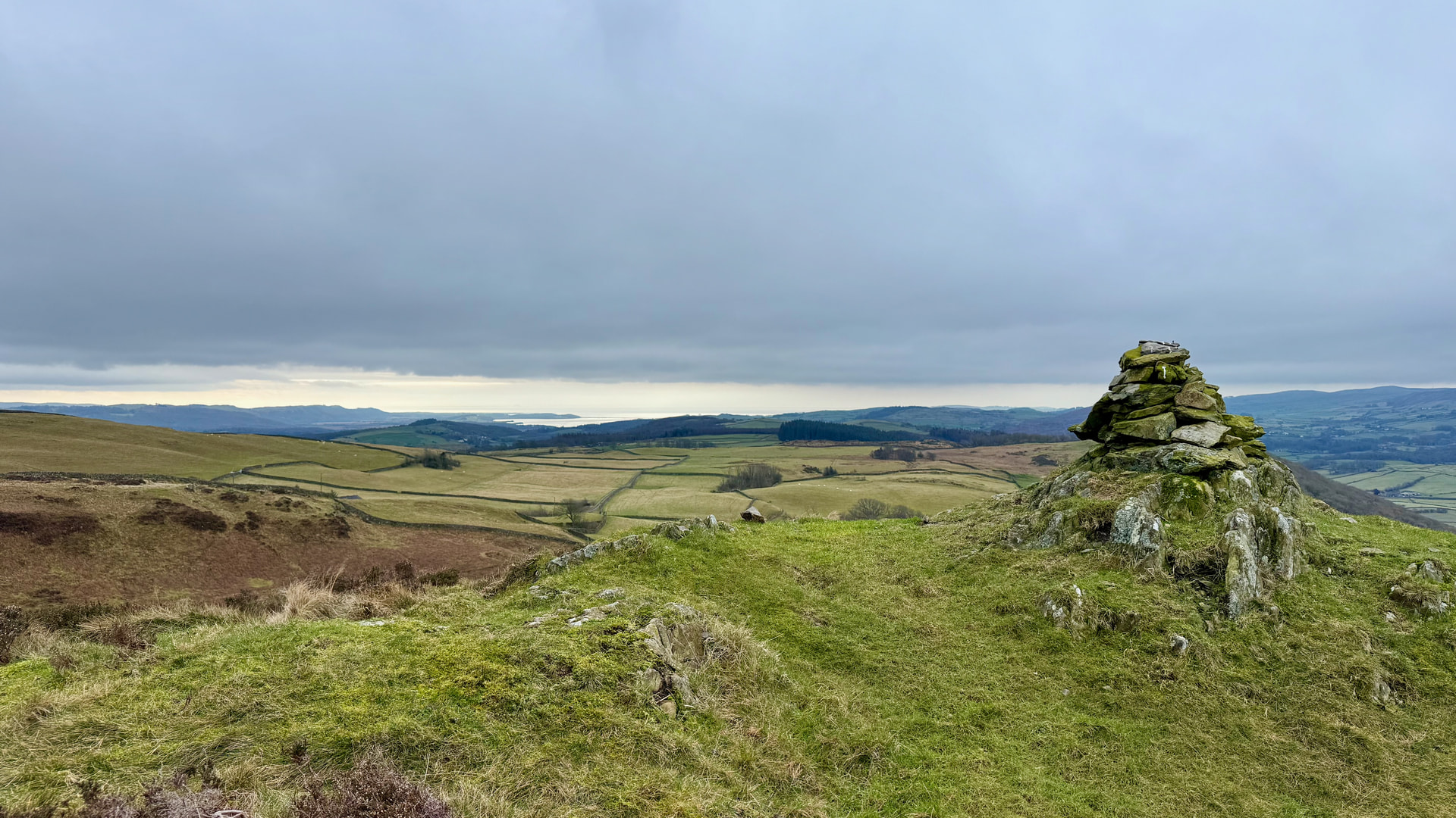
New path marker with fence and gate in the distance
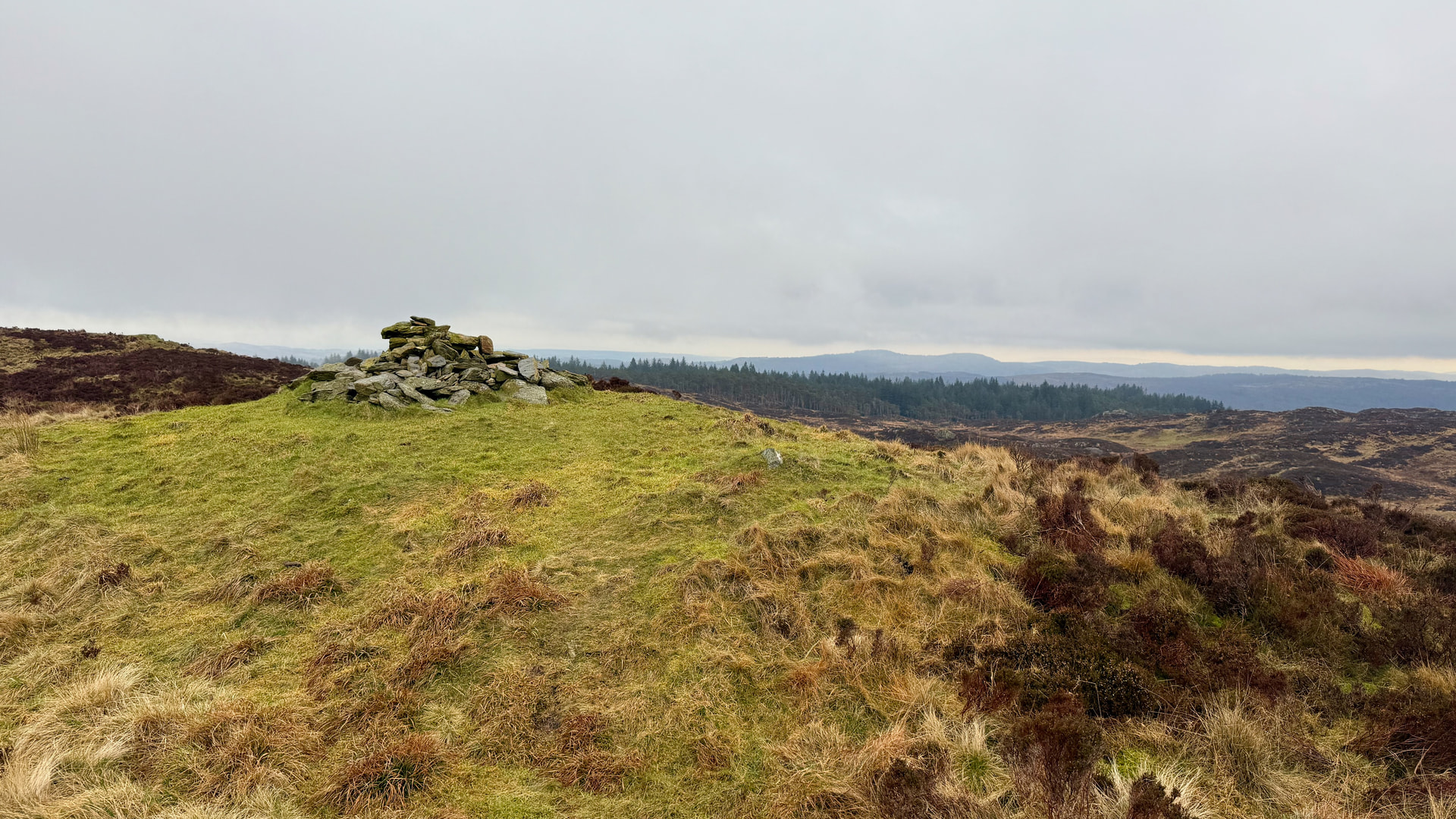
Summit Cairnstone Pile
The plan today was to do HF/VHF from the SOTA summit together with 2m from the WOTAs, attempting CW/SSB from all.
Top O’Selside
| WOTA ID: LDO-064 | Height: 335 m (1099 ft) |
|---|---|
| SOTA ID: G/LD-048 | Grid ref: SD308918 |
| HuMP ID: n/a | QTH Locator: IO84LH |
| Book: The Outlying Fells | Lat: 54.316937 Long: -3.063909 |
Today I was using the FT-817ND with my new 3D printed 18650 battery cell tray. That was to perform flawlessly which was great. On Top O’Selside I erected the SOTABEAMS 20/30/40m Inverted V dipole together with the Spectrum Comms Slim J for 2m. HF was lively with a good run of contacts on both 20m and 40m. It was great to be able to congratulate Esther GI0AZA over the air on her recent Mountain Goat achievement.
| TIME | CALLSIGN | BAND | MODE | RST | RSR | OPERATOR | SIG | REF |
|---|---|---|---|---|---|---|---|---|
| 11:53 | SA4BLM | 20m | SSB | 59 | 57 | Lars | ||
| 11:53 | EA3EVL | 20m | SSB | 55 | 51 | PABLO | ||
| 11:54 | SQ9MDF | 20m | SSB | 59 | 52 | Leszek | ||
| 11:54 | EA1DHB | 20m | SSB | 59 | 54 | Ricardo | ||
| 11:55 | EA7GV | 20m | SSB | 59 | 51 | JOSE | ||
| 11:55 | SQ9JYK | 20m | SSB | 59 | 57 | Piotr | ||
| 11:55 | LY2NZ | 20m | SSB | 55 | 55 | Rimantas | ||
| 11:56 | DD0VE | 20m | SSB | 59 | 58 | Ralf | ||
| 11:57 | EA3HP | 20m | SSB | 59 | 57 | Daniel | ||
| 11:57 | SP9PND | 20m | SSB | 55 | 31 | Milosz | ||
| 11:58 | DL5HCM | 20m | SSB | 59 | 55 | Michael | ||
| 12:00 | OZ1RD | 20m | SSB | 59 | 55 | Rene | ||
| 12:00 | SV3IEG | 20m | SSB | 59 | 55 | Dinos | ||
| 12:01 | DJ7NT | 20m | SSB | 59 | 59 | Joerg | ||
| 12:01 | OM5TX | 20m | SSB | 59 | 59 | Jozef | ||
| 12:01 | DL9NCI | 20m | SSB | 59 | 57 | |||
| 12:02 | OE7RGF/P | 20m | SSB | 57 | 57 | Reinhard | SOTA | OE/TL-050 |
| 12:02 | DL7UJM | 20m | SSB | 59 | 55 | Jürgen | ||
| 12:02 | S57ILF | 20m | SSB | 55 | 44 | FRANCI | ||
| 12:06 | ON4CAS | 40m | SSB | 59 | 59 | Egbert | ||
| 12:07 | GI0AZA | 40m | SSB | 59 | 59 | Esther | ||
| 12:09 | G0FEX | 40m | SSB | 59 | 59 | KEN | ||
| 12:09 | G0MHF | 40m | SSB | 59 | 58 | JOHN | ||
| 12:09 | G4WHA/M | 40m | SSB | 55 | 44 | G | ||
| 12:10 | G0RQL | 40m | SSB | 59 | 56 | DON | ||
| 12:10 | M1AOB/M | 40m | SSB | 59 | 55 | RICHARD | BOTA | B/G-0160 |
| 12:10 | MW9WJS | 40m | SSB | 59 | 55 | John | ||
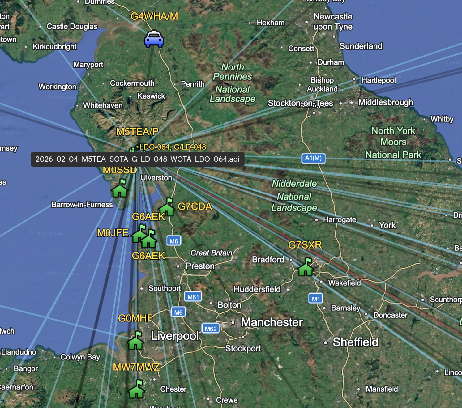
| 12:13 | MW7MWZ | 2m | SSB | 55 | 51 | Mike | ||
| 12:14 | G6AEK | 2m | SSB | 59 | 59 | David | ||
| 12:15 | G7SXR | 2m | SSB | 51 | 41 | Mark | ||
| 12:17 | G7CDA | 2m | FM | 59 | 58 | Douggie | ||
| 12:18 | M0SSD | 2m | FM | 59 | 59 | George | ||
| 12:19 | M0JFE | 2m | FM | 59 | 59 | John | ||
| 12:24 | G6AEK | 2m | CW | 599 | 599 | David |
On 2m SSB the SOTA status of the summit definitely pulled in additional chasers, and everyone offered their Maidenhead without asking. Dave @G6AEK also provided me with a 2m CW contact, breaking my ears with his 59+++ signal ![]()
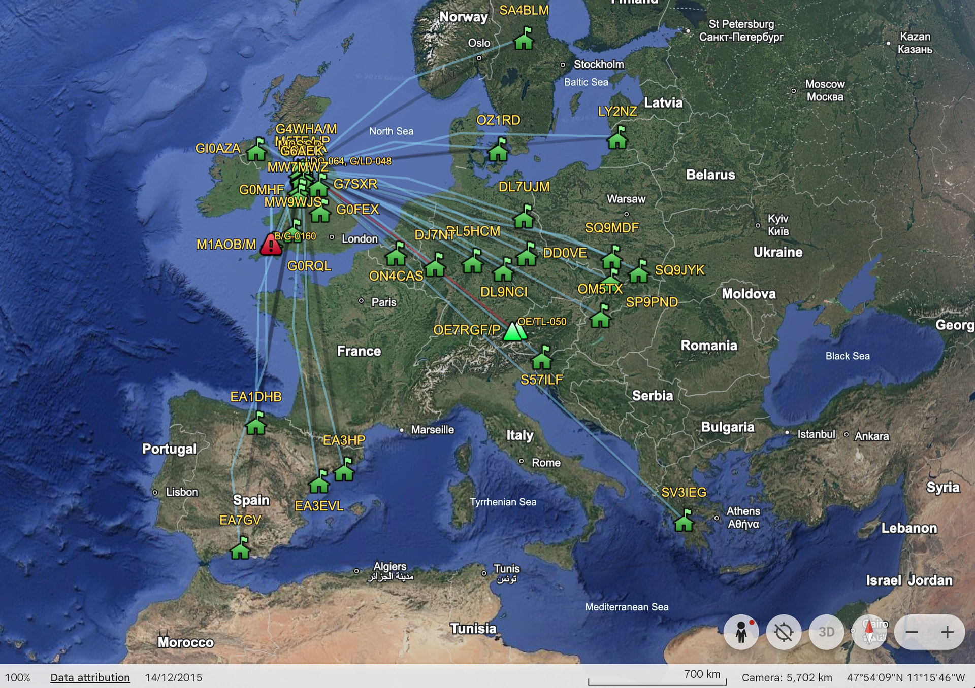
DX Contacts
Local Contacts
After packing up I remembered again that the traverse down to the other WOTAs was a boggy affair last time I was up here, and it was no different this time either. Enough to get the boots completely soaked. My Salomon boots are getting long in the tooth now, grip is almost gone on the bottom and definitely no longer waterproof! It’s about 30 mins to High Light Haw and you need to be careful to stay on course because the fellside is covered in trails in all directions (there is a ridgeline to the left, that isn’t where you want to be).
High Light Haw
| WOTA ID: LDO-085 | Height: 263 m (863 ft) |
|---|---|
| SOTA ID: n/a | Grid ref: SD303904 |
| HuMP ID: n/a | QTH Locator: IO84LH |
| Book: The Outlying Fells | Lat: 54.304288 Long: -3.071268 |
I’d setup on the traverse with my rucksack mounted flowerpot antenna and waist mounted case, so for the remaining WOTAs I was able to get on air in about 30 seconds.
| TIME | CALLSIGN | BAND | MODE | RST | RSR | OPERATOR | SIG | REF |
|---|---|---|---|---|---|---|---|---|
| 13:07 | G7CDA | 2m | FM | 59 | 59 | Douggie | ||
| 13:09 | M0SSD | 2m | FM | 59 | 59 | George | ||
| 13:10 | M0SSD | 2m | SSB | 59 | 59 | George |
Low Light Haw is visible from here and about 15 mins walk.
Low Light Haw
| WOTA ID: LDO-091 | Height: 250 m (820 ft) |
|---|---|
| SOTA ID: n/a | Grid ref: SD301900 |
| HuMP ID: n/a | QTH Locator: IO84LH |
| Book: The Outlying Fells | Lat: 54.300666 Long: -3.074248 |
| TIME | CALLSIGN | BAND | MODE | RST | RSR | OPERATOR | SIG | REF |
|---|---|---|---|---|---|---|---|---|
| 13:22 | G7CDA | 2m | FM | 59 | 59 | Douggie | ||
| 13:23 | G6AEK | 2m | FM | 59 | 59 | David | ||
| 13:24 | M0SSD | 2m | FM | 59 | 59 | George | ||
| 13:24 | M0SSD | 2m | SSB | 59 | 59 | George | ||
| 13:25 | G6AEK | 2m | SSB | 59 | 59 | David | ||
| 13:28 | G6AEK | 2m | CW | 599 | 599 | David |
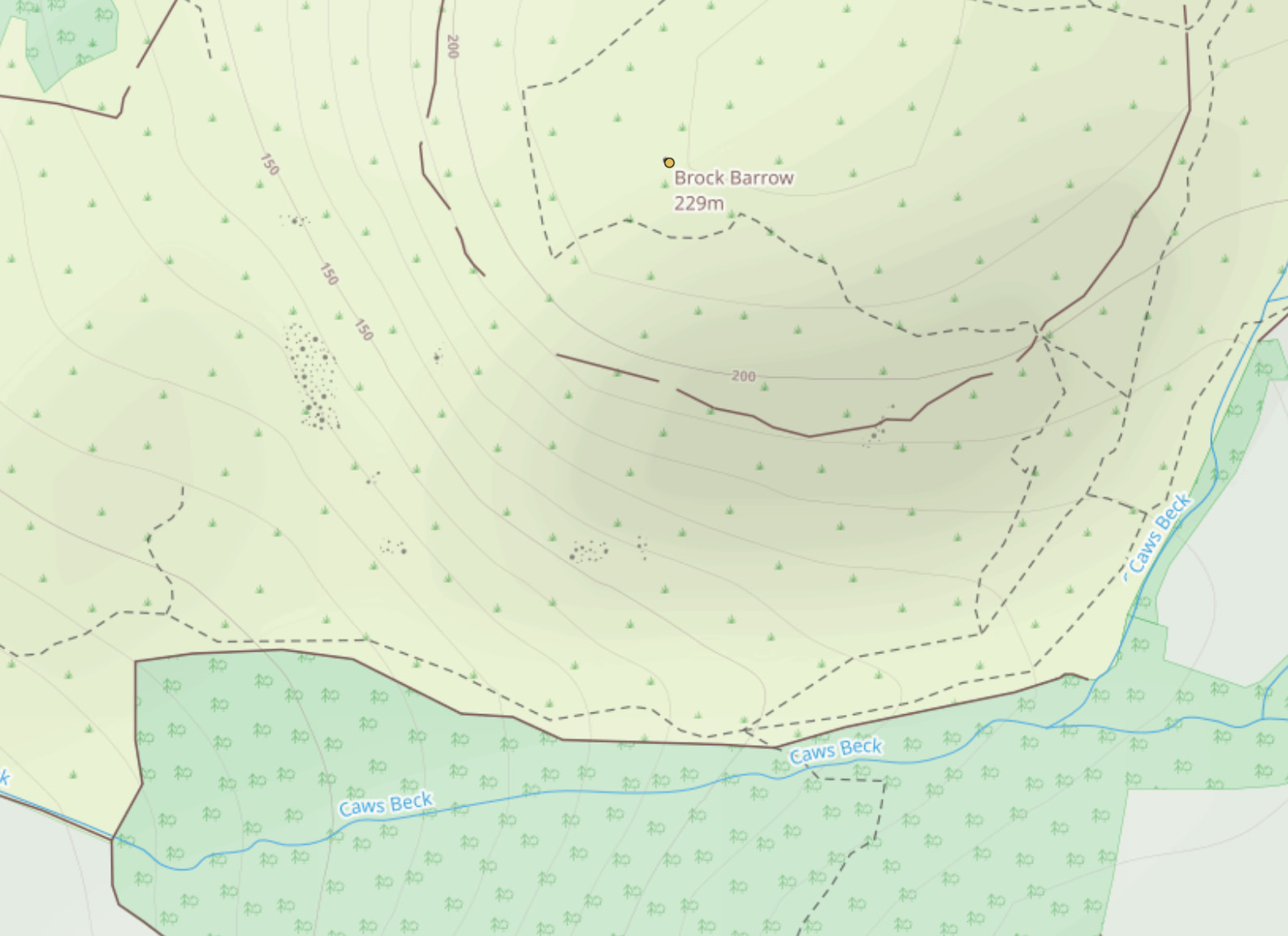
Top O’Selside-Brock Barrow
| WOTA ID: LDO-106 | Height: 229 m (751 ft) |
|---|---|
| SOTA ID: n/a | Grid ref: SD299898 |
| HuMP ID: n/a | QTH Locator: IO84LH |
| Book: The Outlying Fells | Lat: 54.298841 Long: -3.077274 |
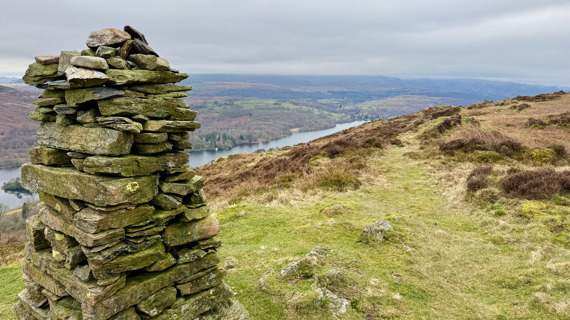
There is quite a large cairnstone pile here, but if you look backwards to the North you’ll see the actual summit marked by a much more modest pile of rocks.
| TIME | CALLSIGN | BAND | MODE | RST | RSR | OPERATOR | SIG | REF |
|---|---|---|---|---|---|---|---|---|
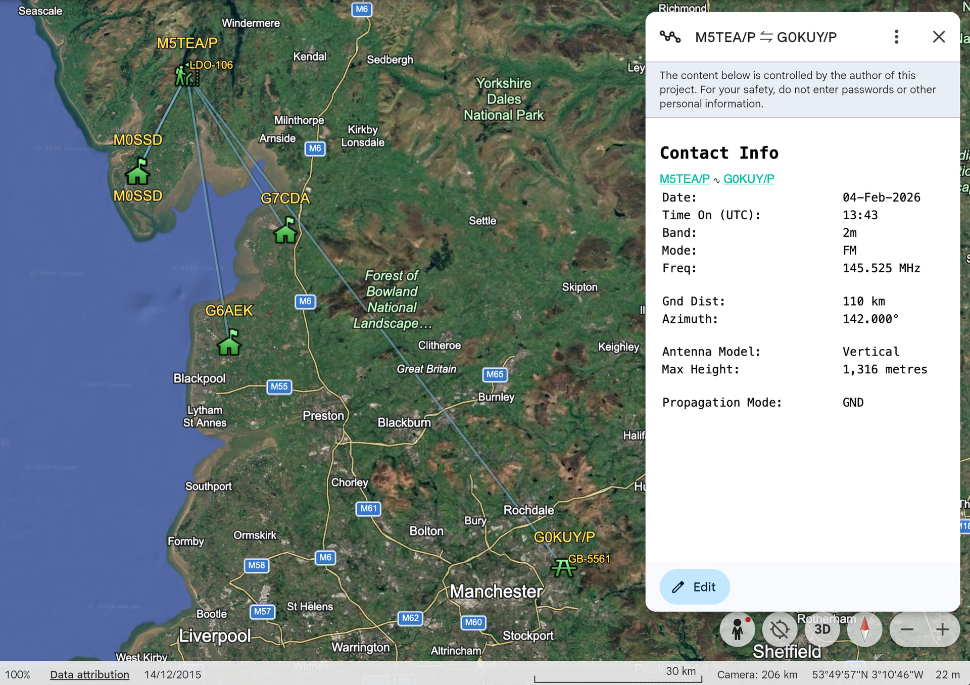
| 13:43 | G0KUY/P | 2m | FM | 54 | 51 | S | POTA | GB-5561 |
| 13:48 | G7CDA | 2m | FM | 59 | 59 | Douggie | ||
| 13:49 | M0SSD | 2m | FM | 59 | 59 | George | ||
| 13:51 | M0SSD | 2m | SSB | 59 | 59 | George | ||
| 13:56 | G6AEK | 2m | CW | 599 | 599 | David |
A decent contact with Steve activating a POTA GB-5561 at 110km using the flowerpot antenna, it’s definitely working!
You’ve got to be careful coming off Brock Barrow as the land drops off sharply to the South and South-West. Cut back to the East where the path is marked and you’ll drop down more modestly to the path next to the woods.
Thanks to all the dedicated chasing today, much appreciated!