Not really a site thing, more of a question about mapping in general, and I mean web based mapping. I’ve started using Komoot to record routes and have started out producing a map using a basic tool (uMap) that uses OSM tiles and a much simpler interface to produce maps than something like Mapbox. Its creaking a bit.
Does anyone have any experience about mapping and importing gpx tracks? Could do with a chat
Ta
btw Fleetwith Pike was chilly on Sunday but nice to get a WOTA activation done for the first time in ages
Alex. I could also do with more knowledge on mapping tracks (routes) as well. I have had a faff going from an old Garmin device to Garmin Basecamp and eventually onto OSM and Google Maps. I can’t recall all the complications, but the whole thing was a pain. I particularly wanted to put pics and info against specific locations / waypoints in the final map producing tool (rather than just dumb flags). So if anyone can point us to smart ways of doing all this stuff, that would be great! 73, Phil
I normally use GPS Visualizer to convert my FT1XD GPS text files to KML format for input to Google Earth. The tool supports conversion between lots of different formats. Google Earth is a nice tool to visualize routes because it shows them in 3D!
The tool may do what you need @PhilM0AYB in one step compared to several.
I used bikehike course creator for years and its pretty good. I like komoot as I can share where I am with mrs g7kse and my watch sync’s to their things so I don’t have to rely on a phone. Still use paper maps / guesswork on the fells though.
The idea for me was more like a sotl.as type map but for my own stuff. i.e which ones I’ve been up, when routes like that. What was the wota website map made with if anyone knows?
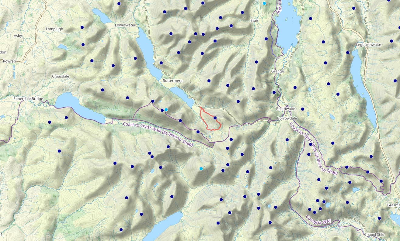
I’ve used uMap for mine so far but it seems to struggle with routes a bit. I’ve put up the sota summits, next up the wotas and there is a test route on their too. (SOTA - uMap)
Thanks, Mark and Alex. I’ll take a look. I’ve found Grid Reference Finder quite handy for producing maps, but I find the whole carry-on quite labour intensive, particularly for occasional use. I think Garmin makes things a bit tricky (particularly the horrible Basecamp software), but don’t think there’s a numbskull’s solution. 73, Phil
Another option: I use the OS Maps app on my phone whilst walking and on my PC at home for planning, etc. I really appreciate the detail in the Ordnance Survey 1:25K maps to navigate around crags or field boundaries. It supports importing and exporting routes in GPX format.
Happy walking,
Andy
P.S. Your qrz.com page gave me a laugh: Winner of ‘Most Amateur Operator’ - I’m sure it’s not true.
Don’t forget the highly commended for ‘Worst CW sent from SOTA Summit, ever’ That’s definitely true…
The mapping I’m after is to record all the tracks I have done. So far I have just uploaded the one track as a dummy and noticed that the interface is quite slow when you need to add in extra data.It looks a bt like this…